Through the Black Forests on the Bonaparte Plateau
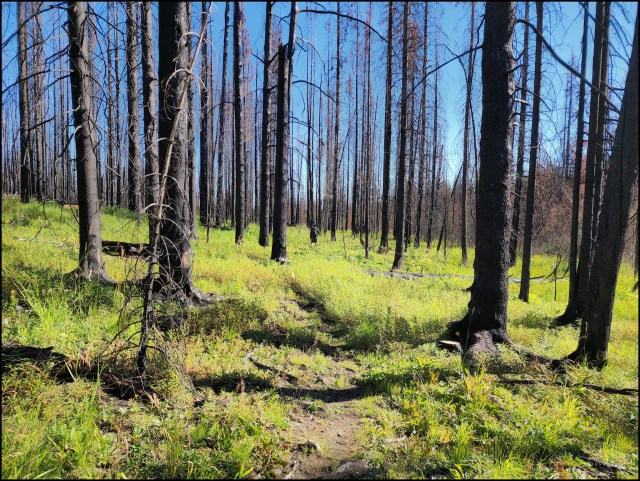
The Sparks Lake Fire of 2021 burned over 90 000 hectares of forest from Red Lake up over the Bonaparte Plateau, including much of Bonaparte Provincial Park. The trails are closed and the roads are not fully accessible. Where the fire burned hot, all traces of trail markers and even the trail itself is hidden by regeneration growth. Blackened lodgepole trees stand, but will fall with windy days or in winter, providing some additional risk. We ventured along grown-over roads then on traces of a trail at the end of summer.
Some of the areas around lakes were spared from the fires, but with little forests surrounding them, windfall is heavy. The lakes are still beautiful spots, but mostly inaccessible now.

We hiked up the hills on burned slopes, not needing a trail.

Some areas were badly scorched and little growth is evident after one year, especially around Skoatl Point.

From atop the hill, we had wide views across the plateau and spotted a few green areas, but mostly burned forests.
 Skoatl Point is the ancient core of a volcano. and it stands up above the ravaged forests, as seen from Adler Lake.

There was not much life in the black forests, but we did spot some grouse and a black bear near green areas. Succession growth is filling in the open spaces with fireweed, alder, lupine, arnica, and some low-growing shrubs.
The road in is grown-over, there are posted signs of the area closure, the trail is hard to see, and there is a lot of windfall and debris. It is not a recommended area to hike until crews can get into assess the trail, clear fallen trees, fell danger trees, and mark the trails. Check out BC Parks website for updates – link.
Doug Smith
Doug writes for Kamloops Trails, a not-for-profit (and ad free) website, offering information on trails, waterways, routes, featured spots, viewpoints, and explorations in the outdoors in the Kamloops area (and beyond).
Doug started exploring this area in 1976 and continues to follow tracks and routes wherever they lead, with the aid of map, compass, GPSr and camera. After many dead-ends, but also many discoveries, he chose to share this information.
The Kamloops Trails website has a massive number of interesting posts and would be of interest to anyone in Kamloops who enjoys the outdoors. Visit the Kamloops Trails website at: http://www.kamloopstrails.ca/
My Blog Posts