Three Brothers Mountain – Kamloops Trails
The Heather Trail starts at the end of the Blackwall Peak Road in Manning Park. The trail bears north, then northwest through subalpine meadows. It can be hiked or backpacked. We even ran the whole length of the trail some years ago. On our last trip to Manning Park, the goal was to hike to the summit of third Brother Mountain and back, a 19.8 km trek.
 We parked at the lower parking lot and followed the trail as it wound down Lone Man Ridge to the Buckhorn Creek campsite. From there was a long climb to open south-facing meadows.

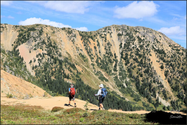
We hiked onto the subalpine meadows of Big Buck Mountain where we spotted the Four Brothers peaks ahead. Manning Park signage and maps does not agree with published maps, nor with Canadian topographic references with regard to the naming of the Four Brothers. We hiked to the “First Brother Trail” (according to signage), but ended up on Third Brother Peak.
 A small tarn lies just off the trail at the foot of the peaks.
 From Second Brother Mountain, Three Brothers Mountain is at the end of a long ridge.

At the bottom of the cirque below lie two tarns, filled with snow meltwaters.
 To the west is Fourth Brother Mountain, best accessed from the Heather Trail meadows. Nicomen Ridge is farther to the west.
 Beyond the Heather Trail, ridges and peaks stretch west into the Cascade Range with Silvertip Mountain in the distance.

After lunch on the summit, we returned back on the same trail with a long decent to Buckhorn Creek.
 The date chosen for the hike meant we had blue skies, no mosquitoes and light traffic on the trail, but the wildflowers were mostly past too, though a few varieties were still in bloom. We were pleased to return to do this hike again. We will be back to Manning Park again to continue hiking the alpine trails of the area.
Directions:
- Drive Highway 3 through Manning Park. At a signed intersection at Manning Park Lodge turn uphill (north) onto the Blackwall Road. Follow signs to the top.
- There are some scenic viewpoints along the way, worth a stop on a clear day.
- There are 2 parking areas near the top. Either one can be used to access the Heather Trail.
- All trail junctions are signed. The best views on the Heather Trail start on the upper slopes of Big Buck Mountain.
Doug Smith
Doug writes for Kamloops Trails, a not-for-profit (and ad free) website, offering information on trails, waterways, routes, featured spots, viewpoints, and explorations in the outdoors in the Kamloops area (and beyond).
Doug started exploring this area in 1976 and continues to follow tracks and routes wherever they lead, with the aid of map, compass, GPSr and camera. After many dead-ends, but also many discoveries, he chose to share this information.
The Kamloops Trails website has a massive number of interesting posts and would be of interest to anyone in Kamloops who enjoys the outdoors. Visit the Kamloops Trails website at: http://www.kamloopstrails.ca/
My Blog Posts