Skoatl Point in the Fall
Skoatl Point is a favorite hike so we try to plan for it each year. It is a wet route in the summer so we schedule our hike for late summer or early fall. This year we picked a fine day for the hike. We drove on the Jamieson Creek Forest Service Road for 28 km to Whitewood Lake, then we turned onto the Windy Lake Road (for 8 km). The road continues as a narrow double track (for 1.5 km) to the Skoatl trailhead.
 The first 2 km of the hike is on a good trail through the forest. The route descends down to Adler Lake. At the south end of the lake is a viewpoint of Skoatl Point.
 The trail winds around the shores of Adler Lake for 1.3 km then starts to climb through a regenerated lodgepole pine forest to the base of the volcanic plug. Angular blocks of basalt litter the base of the hill.
 The route up the volcanic core is a climb, following blocky ridges to the top. A stunted tree grows in the cracks at the top.
 Dagger Lake lies below Skoatl Point on the north side. Bonaparte Lake is in the valley 11 km farther north. From the summit we could spot 10 lakes of many situated on the Bonaparte Plateau.
 To the northeast Dunn Peak stood at 8640 feet, high above all other peaks of the area, 47 km away.
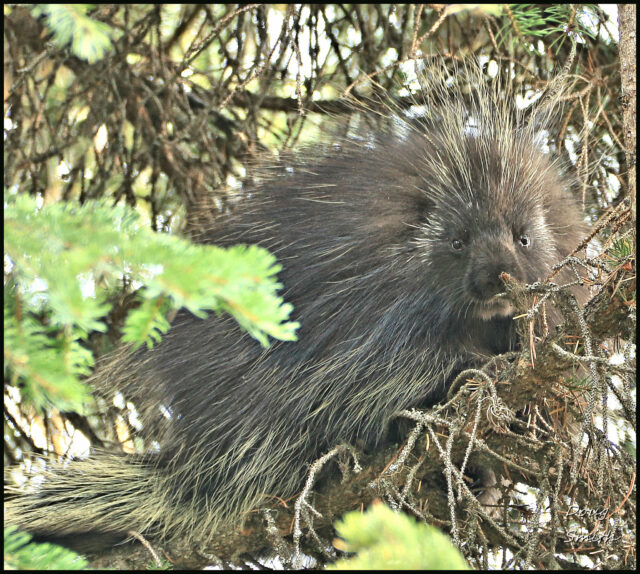
 On the way back we treed a porcupine near Adler Lake. I climbed onto windfall to get high enough to get a face-to-face view on the creature.
 At the end of the hike, we spotted a spruce grouse, standing still just off the trail.
 The Skoatl Point hike is 8.6 km. Much of the route is a good trail in the forest, but the final section is a scramble on rock, not for everyone. There are good foot placements and handholds all the way up, but the route has some exposure too and the downclimb can be intimidating for some. For some of us, the scramble makes the hike interesting and enjoyable. The unique hike is in a remote backcountry area, all high on the Bonaparte Plateau.
Doug Smith
Doug writes for Kamloops Trails, a not-for-profit (and ad free) website, offering information on trails, waterways, routes, featured spots, viewpoints, and explorations in the outdoors in the Kamloops area (and beyond).
Doug started exploring this area in 1976 and continues to follow tracks and routes wherever they lead, with the aid of map, compass, GPSr and camera. After many dead-ends, but also many discoveries, he chose to share this information.
The Kamloops Trails website has a massive number of interesting posts and would be of interest to anyone in Kamloops who enjoys the outdoors. Visit the Kamloops Trails website at: http://www.kamloopstrails.ca/
My Blog Posts