Hiking the Wounded Knee Trail
One of our favorite hiking areas is in the Lundbom Grasslands (Commonage). We usually hike a route in June and sometimes return for a different route in the fall. On a fine June morning we drove through Merritt, then up Highway 5C, turning onto the Lundbom FSR. We parked near Lundbom Lake and hiked toward Hamilton Lake.
We had hiked to the top of Sugarloaf Mountain before and we have also hiked the Cocobonk and Wounded Knee Trails before, but we opted for a different set of trails for a 13 loop route through the grasslands and open forests. Hamilton Lake and Sugarloaf Mountain were west of our trailhead.
 We turned onto the Cocobonk Trail, a double track that climbs over the hills, passing aspen groves, grassland meadows, and sections of douglas fir forest.
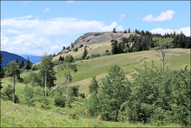
 There are no dramatic peaks, cliffs, gorges, or high viewpoints in the area. But there are verdant grasslands, aspen groves, open forest, wildflowers, quiet dales, ponds and lakes, and peaceful slopes. We enjoy exploring the various routes, leaving nothing in our wake.
 At a shaped tree on the edge of a hill, we stopped for lunch, enjoying the wildflower slopes around us.
 There are a few signs at intersections, installed by mountain bikers. The older double tracks have been there for a century, but the single tracks are new, cut by bikes and cattle grazing on the Commonage. There are more routes to explore.
 We returned over the shoulder of Sugarloaf Mountain (really just the highest hill of the area). The best views are from the top of the mountain.
 In the distance we had glimpses of Stoyama Mountain, the northernmost peak of the Cascade Range.
 Our hiked returned us to Hamilton Lake on the way back to the trailhead. We have already planned our next hike in the area.


Doug Smith
Doug writes for Kamloops Trails, a not-for-profit (and ad free) website, offering information on trails, waterways, routes, featured spots, viewpoints, and explorations in the outdoors in the Kamloops area (and beyond).
Doug started exploring this area in 1976 and continues to follow tracks and routes wherever they lead, with the aid of map, compass, GPSr and camera. After many dead-ends, but also many discoveries, he chose to share this information.
The Kamloops Trails website has a massive number of interesting posts and would be of interest to anyone in Kamloops who enjoys the outdoors. Visit the Kamloops Trails website at: http://www.kamloopstrails.ca/
My Blog Posts