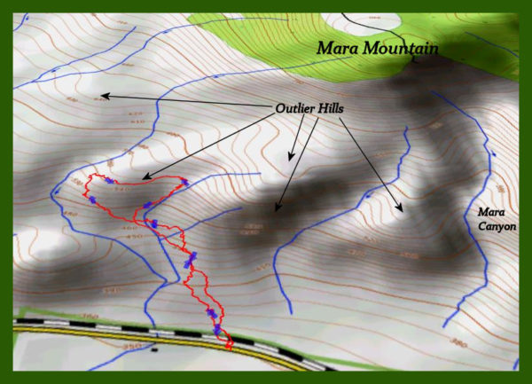
Hiking the Mara Outlier Hills in Late Winter
When the weather starts to warm, the first areas to completely clear of snow and dry up are the south facing ridges. When the sun is low in the sky the angle of the sun’s rays are angled through the atmosphere so they are strongest at 90 degrees to the height of the sun at the time. In late February the sun is at about a 36 degree angle so any ridge that is at the opposite angle will receive the strongest melting rays. In addition, any of the steeper slope dry faster because gravity clears away the moisture and on ridges, the drainage is in 3 directions. Lastly, the tops of ridges are the most exposed to drying winds. To find the first dry routes climb up south-facing ridges at the lowest elevation available. The lower slopes of Mara Mountain offer some of the earliest “dry” hiking, but there are no trails. On this day in the third week of February, I just parked and started climbing ridges to the tops of the outlier hills, looking for the driest reasonable route for a modified loop hike.
All routes involve weaving through sagebrush and up ridges, finding the best path for each section along the way. There were some muddy spots and some snow drifts, so I just went around those.
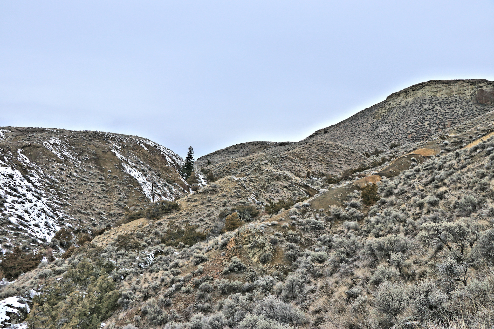 The cracked, orange-silt slopes were muddy so I skirted those. There are many hoodoos, spires, gargoyles, and cliffs on the hills in the area to explore from many different perspectives.
 A mysterious feature hidden from below are two spiral rock patterns. There is a similar feature called The Lytton Jellyroll, but that was created by a slide in sedimentary materials, whereas this seems to be volcanic in origin.
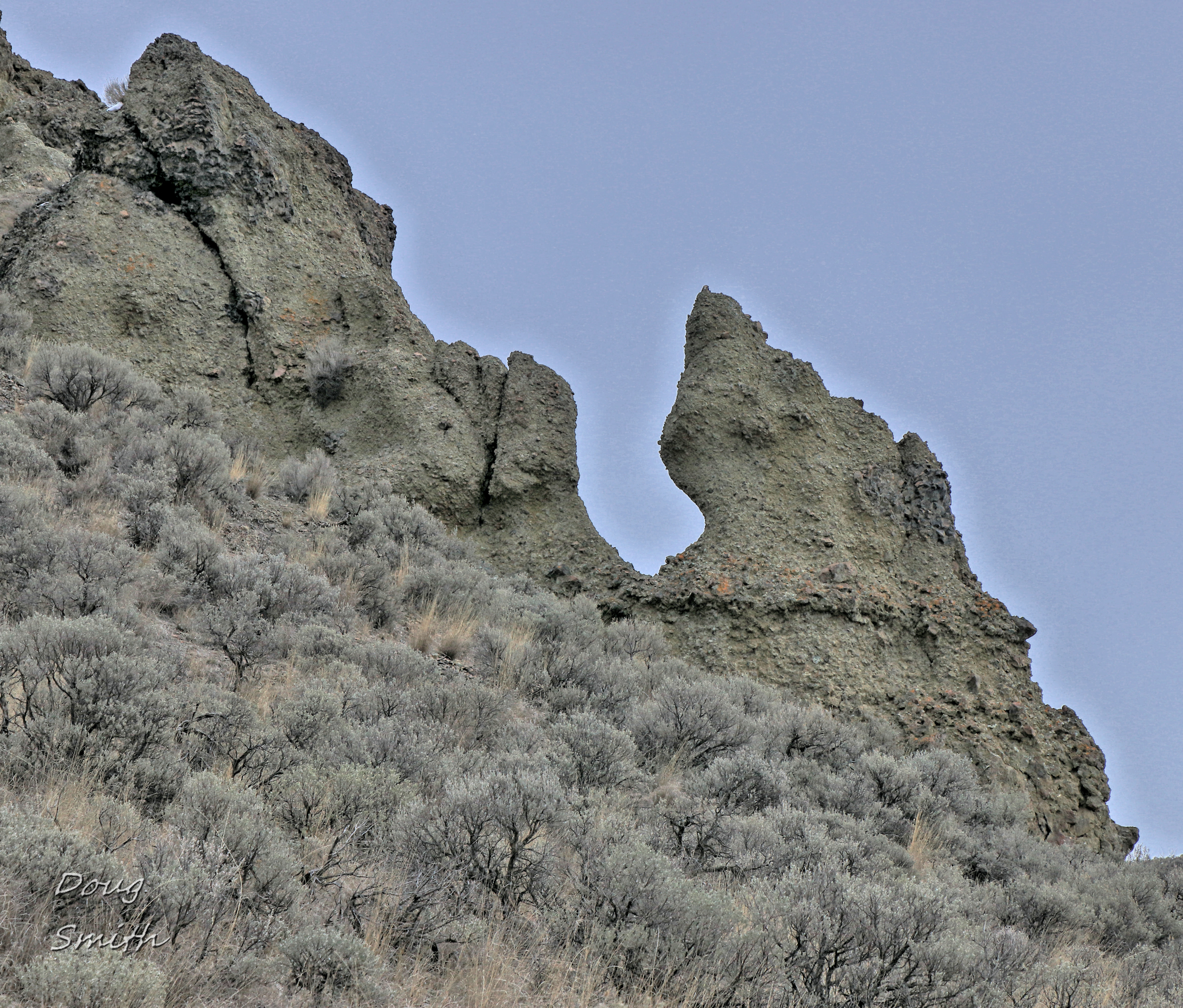
 Eroded spires, rock towers, and hoodoos can be found at various points on the slopes and cliffs
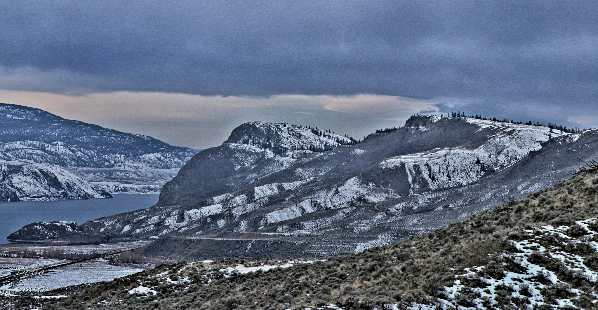
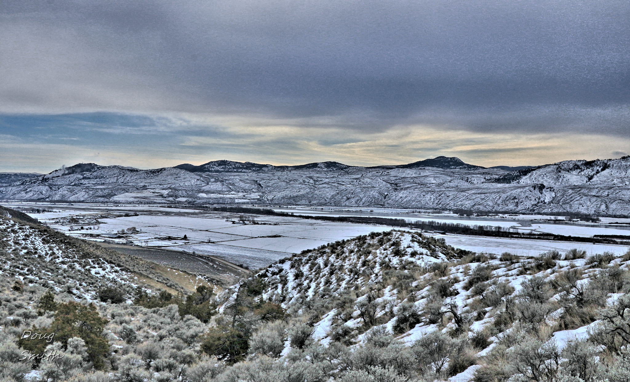
 Across the river the hills were still snow-covered. Some brighter light silhouetted Sugarloaf Hill to the south.
 There were some drier south-facing ridges between Tranquille and Battle Bluff too which is another alternative area for exploration.
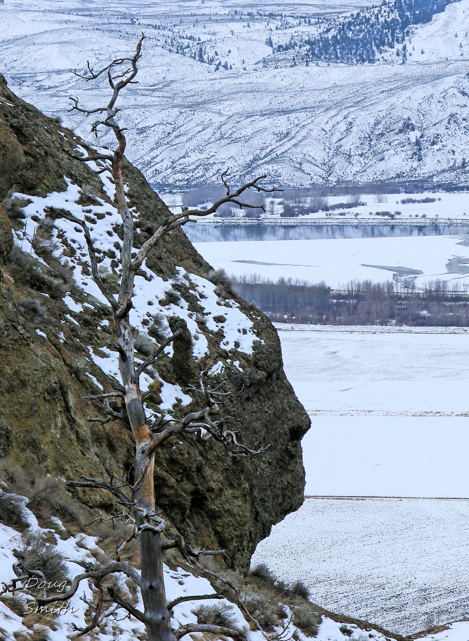
 From a specific place in the hills, I was able to get to a facial profile view of a bluff that we sometimes call Face Rock.
 There were some steep slopes, but by choosing the right angled slope, the path was safe and dry for a winter hike in the Mara SW Outlier Hills.
Doug Smith
Doug writes for Kamloops Trails, a not-for-profit (and ad free) website, offering information on trails, waterways, routes, featured spots, viewpoints, and explorations in the outdoors in the Kamloops area (and beyond).
Doug started exploring this area in 1976 and continues to follow tracks and routes wherever they lead, with the aid of map, compass, GPSr and camera. After many dead-ends, but also many discoveries, he chose to share this information.
The Kamloops Trails website has a massive number of interesting posts and would be of interest to anyone in Kamloops who enjoys the outdoors. Visit the Kamloops Trails website at: http://www.kamloopstrails.ca/
My Blog Posts