Hiking the Battle Creek Hills
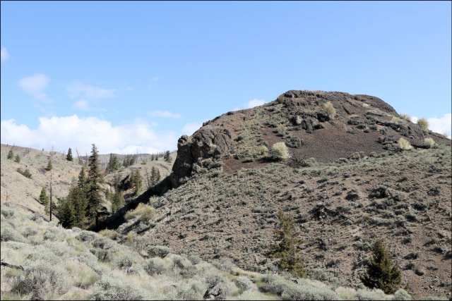
The Cache Creek Hills extend from Battle Creek (west of Juniper Beach) to Cache Creek. The range has open sagebrush – grassland slopes on the south side and forested slopes on the north side. Forest fires have burned the forest and have left charred stumps. Access is limited by rangeland fences, but we can access some routes from the Battle Creek FSR, the Back Valley FSR, or Highway 1. Any access should respect grazing cattle, closed gates, and posted signs. The McAbee Heritage Site is closed to the public at this time so we should hike around the site boundaries. We started the long climb to the top of the ridges with no one around and only occasional sightings of wildlife.
As we climbed we could see across the Cache Creek Hills to other hills. Rattlesnake Hill is the highest point in the range (another hike to be done from the back side). We hiked to the highest point on the Battle Creek side of the range.
 It was easier to climb up than come down, especially since we tried to do a loop route and had to descend steep slopes and deep gullies. A few images are shared in a gallery. Click any image for a lightbox view and a caption.


As we dropped down the ridge we had views of the lower Battle Creek FSR and upstream in the Thomspon River Valley toward Walhachin.
 A few short video clips were taken while hiking on the 8.5 km route.
The elevation gain was over 1800 feet. Hiking is best done in the spring or fall. There is no shade until the top. The area is a bit remote and it is unlikely you will encounter anyone else. I hope to return to hike to the top of the western side of the range from the Back Valley Road.

Doug Smith
Doug writes for Kamloops Trails, a not-for-profit (and ad free) website, offering information on trails, waterways, routes, featured spots, viewpoints, and explorations in the outdoors in the Kamloops area (and beyond).
Doug started exploring this area in 1976 and continues to follow tracks and routes wherever they lead, with the aid of map, compass, GPSr and camera. After many dead-ends, but also many discoveries, he chose to share this information.
The Kamloops Trails website has a massive number of interesting posts and would be of interest to anyone in Kamloops who enjoys the outdoors. Visit the Kamloops Trails website at: http://www.kamloopstrails.ca/
My Blog Posts