Hiking in the Hamilton Corrals Commonage
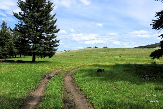
There is a commonage (publicly owned lands) at the height of the road that climbs from Quilchena to the Minnie Lake area (Pennask Lake Road). The area is over 4000 feet and there are a number of fences for seasonal grazing licenses, but hikers can access the area at the right time, respecting grazing cattle, closing gates, and leaving nothing but temporary footprints. When we hiked the area in early June there were no cattle grazing, but on adjacent private lands were grazing horses. We had done this area a few times so we knew a good route. We mostly followed double tracks in a 13+km loop.
 This high grassland slopes have many ponds along the way, all surrounded by green spring growth.
 Clusters of aspens were leafing out.
 A few ducks dabbled on ponds, hawks circled overhead, we saw one bear, birds were heard in the otherwise quiet area, and pollinators were busy on flowering plants.
 The double track wound to the southern slopes of Mount Hamilton, then we took a right fork to go around the ridge in the middle of the Commonage.
 On the east side of the high ridge was a large pond with a sign at the shoreline naming it “Jack’s Pond.”
 For the last third of the hike we left the double tracks (we could have followed them out to the Pennask Lake Road), and just navigated our way back to the start area, crossing low ridges, and ascending open grassland slopes.
This area is only suitable for hikers who can navigate the area (map and compass, mapping app, or GPS) at seasonally appropriate times, but is a beautiful area for a few self-sufficient hikers to explore.
More Information:
Doug Smith
Doug writes for Kamloops Trails, a not-for-profit (and ad free) website, offering information on trails, waterways, routes, featured spots, viewpoints, and explorations in the outdoors in the Kamloops area (and beyond).
Doug started exploring this area in 1976 and continues to follow tracks and routes wherever they lead, with the aid of map, compass, GPSr and camera. After many dead-ends, but also many discoveries, he chose to share this information.
The Kamloops Trails website has a massive number of interesting posts and would be of interest to anyone in Kamloops who enjoys the outdoors. Visit the Kamloops Trails website at: http://www.kamloopstrails.ca/
My Blog Posts