Above Lac du Bois – Kamloops Trails
For most of the summer we follow established trails up ridges and to high points. When fall arrives, the higher points may be snowed in and backroads and trails to high points can become muddy and difficult to access. In the valley bottom and in the hills that surround us, access lasts longer so we often turn to these trails but also to new routes from known spots. On a recent fall day, I started at Lac du Bois, but chose to climb up to a prominent hill above the lake, then continued along a north-south ridge, off-trail, but in touch with the landmarks of the area. The route was 5. 3 km with some nice viewpoints.

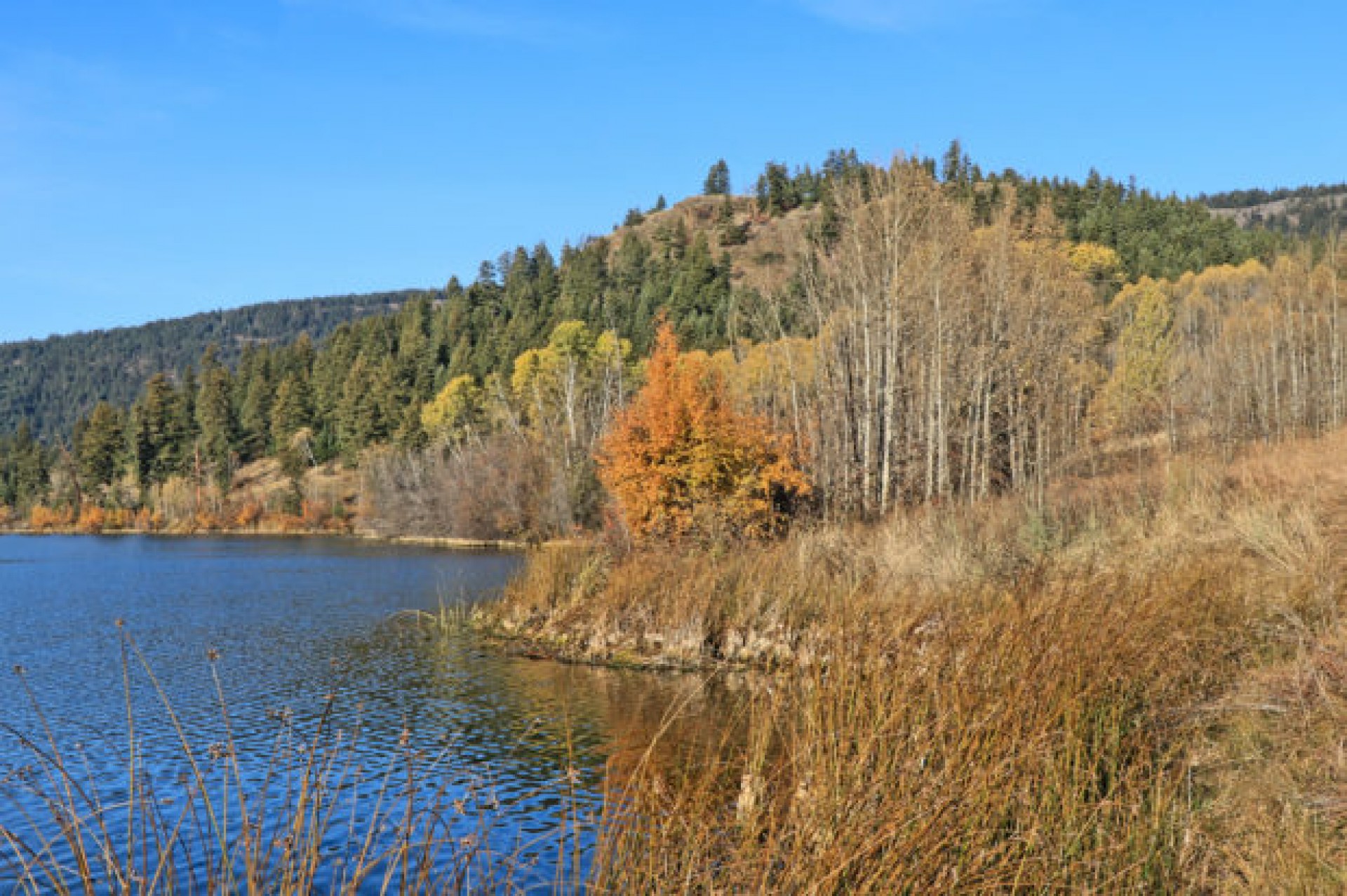
Fall colors surround Lac du Bois. I walked around the north side of the lake to the foot of the hill shown in the following image.

I started to climb the hill, angling onto open steep slopes. Near the top, volcanic rock outcrops topped the hill.

The best reason for going up ths hill is the views from the top. To the east the upper grasslands of the Nature Conservancy stretch for 3 km to Clapperton Ridge.

From the top of the second hill I had good views south, looking into the sun. The isthmus of Lac du Bois is an esker, a remnant of glacial deposits in a kettle.

From the end of the ridge, the route was across a legacy grazing fence and then down into the forest under Opax Mountain. Old homesteads were established in that area and trees were cut for pastures and farmland. Open glades can still be found, but many are now populated by young forests, including aspen groves.

I started the return route down the west side of the ridge aiming generally south. There was some thicker forest in the gullies but there was more open forest farther west as it approached Hanging Valley. the route descended down to the Hanging Valley track which I then followed back to Lac du Bois.

I plan to go back up there, looking for a better (connector) route from the Hanging Valley – Opax Mountain track, using old skid roads and homesteader clearings. It may take a couple of explorations to find the best loop route. This is how all of the routes shared on this site were found, explorations and linkages made over time.
Doug Smith
Doug writes for Kamloops Trails, a not-for-profit (and ad free) website, offering information on trails, waterways, routes, featured spots, viewpoints, and explorations in the outdoors in the Kamloops area (and beyond).
Doug started exploring this area in 1976 and continues to follow tracks and routes wherever they lead, with the aid of map, compass, GPSr and camera. After many dead-ends, but also many discoveries, he chose to share this information.
The Kamloops Trails website has a massive number of interesting posts and would be of interest to anyone in Kamloops who enjoys the outdoors. Visit the Kamloops Trails website at: http://www.kamloopstrails.ca/
My Blog Posts