Twilight Hill Hike – KamloopsTrails
Twilight Hill is an outlier, a steep and rocky hill on the north side of Sunset Mountain. Neither is listed on maps and in most cases Sunrise Mountain isn’t either, although most locals called it that name. To the west is Sunset, one of the twin mountains/hills between Barnhartvale and Juniper Ridge. We have hiked over Sunset Mountain from the east and from the west, but the north side is much too steep and rocky. Twilight Hill can be hiked from the Uplands Trails area, following steep single tracks. At junctions, we have to go left or right, so some navigation is required. Some waypoints are provided at the bottom.
In mid-September, I climbed a series of steep trails up onto the ridge/hilltop of Twilight Hill.

The north-facing slopes are treed with some pinegrass in the open forests,

As the trail climbs we are rewarded with views looking north to the South Thompson River.

From the top of Sunrise Hill we have wide views in three directions, a rewarding spot for a break.

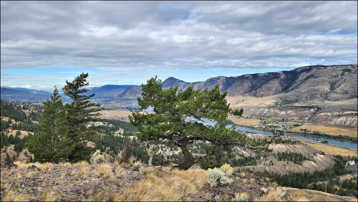
At the western end of the ridge we have fine views looking west through the valley.

From Twilight Hill a single track goes down through a pass and towards the deep gully between the Barnhartvale hills and Juniper Ridge and Rose Hill. A trail winds down and a fork leads to a trail going east, over one of the lower hills, and down toward the trailhead at the junction of McLeod and Uplands Roads.

The trails up are steep, but the hilltop views are worth the effort. This is a very nice loop, one that I will return to do next year.
The waypoints provided here are close, but not necessarily precise:
- Trailhead – N50 39.615 W120 11.738
- Junction – go up – N50 39.626 W120 12.002
- Trail junction – bear left – N50 39.482 W120 12.060
- Trail junction – go right – N50 39.384 W120 11.948
- Out to the viewpoint on top – about N50 39.326 W120 12.158
- Return to the trail in the pass and follow it down.
- The return trail starts at about N50 39.294 W120 12.602
- Stay on the trail until it meets the trail you were already on.
Doug Smith
Doug writes for Kamloops Trails, a not-for-profit (and ad free) website, offering information on trails, waterways, routes, featured spots, viewpoints, and explorations in the outdoors in the Kamloops area (and beyond).
Doug started exploring this area in 1976 and continues to follow tracks and routes wherever they lead, with the aid of map, compass, GPSr and camera. After many dead-ends, but also many discoveries, he chose to share this information.
The Kamloops Trails website has a massive number of interesting posts and would be of interest to anyone in Kamloops who enjoys the outdoors. Visit the Kamloops Trails website at: http://www.kamloopstrails.ca/
My Blog Posts