Watching Creek Hike – KamloopsTrails
On an early fall day I drove up the Tranquille – Criss Creek Road, above the canyon and parked near the bridge over the river (Tranquille Crossing. I hiked along an old double track which bears southeast, downriver toward the confluence of Watching Creek and the Tranquille River. The old road was used by rockhounds and goldpanners to get to the agates in the Watching Creek Canyon, and to the river. I can remember when there was a bridge over the river that was used to haul out ore. It was swept away during a spring freshet decades ago. There was also a foot bridge across Watching Creek, and another one farther down Tranquille River. Anyone wanting to goldpan or rockhound can go down from the former Rec Site and cross the river in late summer or fall. There is a trail on the rim of the canyon going south. there are also rough trails over to the Watching Creek double track trail, but it will require a crossing of Watching Creek. There is another trail that goes from the former Rec Site and continues south along the western rim of the canyon. Another side trail drops down to the river so it is possible to hike a loop route with two crossings of the river (see the link below).

For this end of September hike I started at Tranquille Crossing and hiked down the double track for 3 km to the bench above the confluence area.

I used a steep informal trail to get down to the creek, then I rockhopped across, being careful on slippery rocks. The trail on either side of the crossing is grown over, but with careful observation, the route is clear.

Once up on the bench on the east side of the river, I came to an open grassy pasture. remains of an old homestead can be found just above. It was homesteaded by Paddy Docksteader who was a horse trader. He had worked for the Buffalo Bill Wild West Show, but journeyed north to become a homesteader in this backcountry spot.

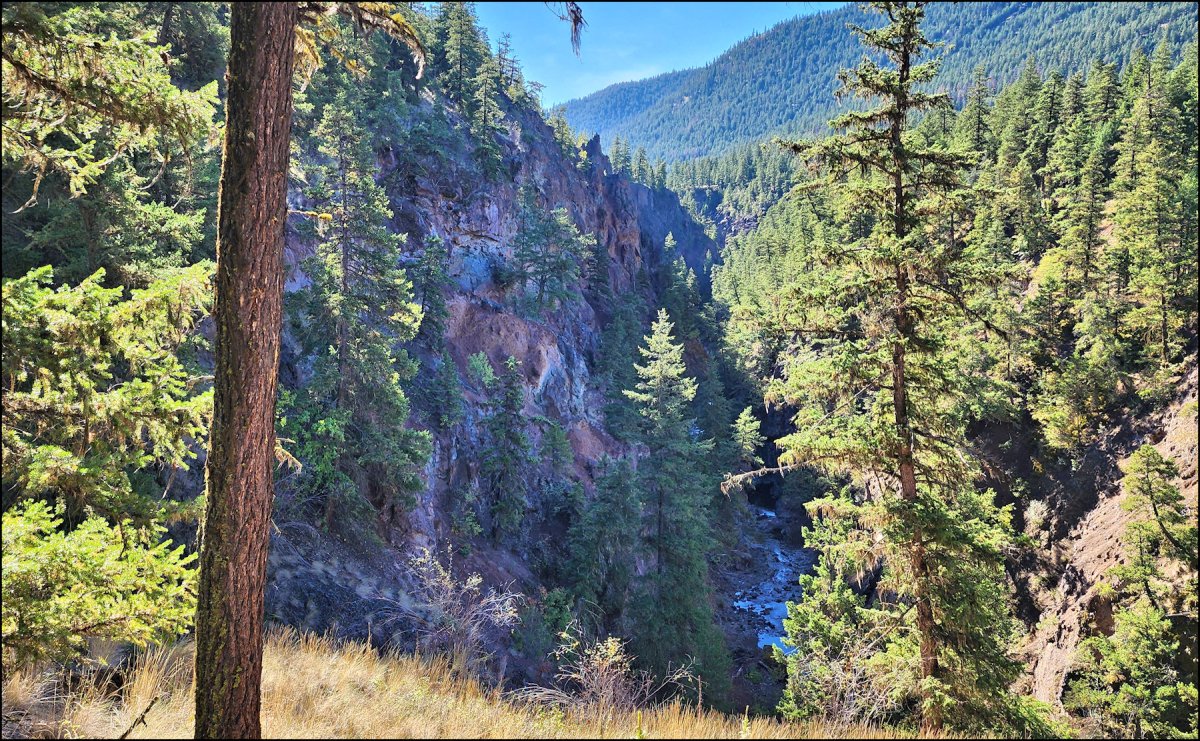
The trail becomes more distinct when two trails merge and there are some trail markers to help out. There are several good viewpoints of colorful cliffs and ragged hoodoos above the canyon. .

contFor this day I chose an out-and-back route, returning by mostly the same route, although I explored a side trail which went onto the bluff directly above the confluence. After some bushwhacking, I crossed the creek and hiked back along the double track.

This hike was a 3 hour, 10 km quiet hike in the backcountry. For anyone wanting to do this hike, some navigation is required and a willingness to cross the creek (or the river) is part of the adventure.

More Information:
Doug Smith
Doug writes for Kamloops Trails, a not-for-profit (and ad free) website, offering information on trails, waterways, routes, featured spots, viewpoints, and explorations in the outdoors in the Kamloops area (and beyond).
Doug started exploring this area in 1976 and continues to follow tracks and routes wherever they lead, with the aid of map, compass, GPSr and camera. After many dead-ends, but also many discoveries, he chose to share this information.
The Kamloops Trails website has a massive number of interesting posts and would be of interest to anyone in Kamloops who enjoys the outdoors. Visit the Kamloops Trails website at: http://www.kamloopstrails.ca/
My Blog Posts