Up the NE Mara Route
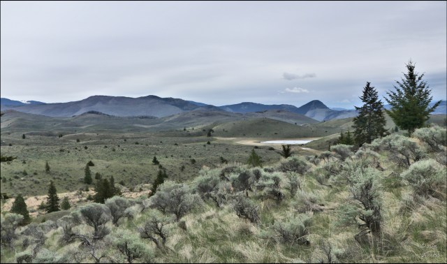
Every year I hike to the summit of Mara Mountain and the most frequent route used is a route from Pruden Pass up the northeast side of the mountain to the top. It is the shortest route with the least elevation gained, but there are no trails for half of the route, but the way is straightforward, winding up through grasslands and sagebrush to the forest angling up to a benchland at the one kilometer mark. There are faint traces of a trail and some flagging tape, but any route will do.
contOn the benchland is an old cart track, remains of a homestead building and a large open, muddy pond, the former homestead of the Damgaard family (1912 – 1917).

From the south end of that benchland meadow hikers can pick up a distinct trail which climbs up through the forest to the summit ridges.

The trail bears southwest, then drops into a gully and back up to the front (south side) of the mountain. There is an excellent viewpoint there, a fine spot for lunch and exploration.

Views extend in 3 directions over the Thompson River Valley, Kamloops Lake, the Dewdrop Range, Greenstone and Chuwhels Mountains, Mt. Paul and Peter and all the hills toward Tod Mountain.

This is a 7.8 km return hike taking about 3 hours, a hike we will return to do again next May.
More Information:
Doug Smith
Doug writes for Kamloops Trails, a not-for-profit (and ad free) website, offering information on trails, waterways, routes, featured spots, viewpoints, and explorations in the outdoors in the Kamloops area (and beyond).
Doug started exploring this area in 1976 and continues to follow tracks and routes wherever they lead, with the aid of map, compass, GPSr and camera. After many dead-ends, but also many discoveries, he chose to share this information.
The Kamloops Trails website has a massive number of interesting posts and would be of interest to anyone in Kamloops who enjoys the outdoors. Visit the Kamloops Trails website at: http://www.kamloopstrails.ca/
My Blog Posts
