Up Jag Hill – Kamloops Trails
When upper areas become snowy and muddy in the fall, we look for double tracks or south-facing open ridges to get to higher terrain. A good option at this time of year is to hike to the top of Jag Hill. We have hiked to Jag Hill from the Red Plateau Forest Service Road on various routes, but we also know routes that start from the Tranquille – Criss Creek Road when the forest service roads become too muddy. The best route for this kind of ascent starts at the parking area for the Pimple (across from the junction with the Red Plateau Forest Service Road). There is a single track used by mountain bikers for the Dewdrop Traverse route, but we find it to be overgrown in summer and fall. An easier trailhead starts off the left side of the Red Plateau Forest Service Road 140m up the road. We hiked up the old double track.
 The open forest provides some views to the southeast on the way up.
 After 2 km of hiking up the ridge, views open up over to Mt. Mara and Pruden Pass. The route out to the top open end of Jag Hill can be a bit hard to find. We can’t see the end point for 2/3 of the route so we remind ourselves to stay on top of the ridge, going up and down over hills and through gullies, but we turn left or right to stay on top of the hills and ridges as we bear south.
 From the top of Jag Hill we enjoyed views southwest over the forested escarpment down to the Dewdrop Range and Kamloops Lake.
 Directly west are the steep slopes of the Red Plateau Escarpment. Castle Butte is visible 3 km away.
 From the end of Jag Hill there are fine views of Mount Mara and the Thompson River Valley.
 There was still some snow in sheltered spots, but there was also a bit on top of Jag Hill at 1103 m (3619 ft).
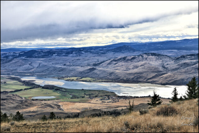
 The Thompson River delta sandbars are starting to show as the river’s flow lessens. Some of these make good walking routes in winter and early in the spring.
 We angled down the steep slopes off-trail to hike a loop route. We had done this before so we knew the general route down to the old double track, then retraced our steps back to the trailhead. The 6 km hike took about 2 and 1/4 hours. The route is a good one in the fall, but some navigation is required. The rewards of fine views are worth the time to climb and explore the east end of red Plateau.
More Information:
Doug Smith
Doug writes for Kamloops Trails, a not-for-profit (and ad free) website, offering information on trails, waterways, routes, featured spots, viewpoints, and explorations in the outdoors in the Kamloops area (and beyond).
Doug started exploring this area in 1976 and continues to follow tracks and routes wherever they lead, with the aid of map, compass, GPSr and camera. After many dead-ends, but also many discoveries, he chose to share this information.
The Kamloops Trails website has a massive number of interesting posts and would be of interest to anyone in Kamloops who enjoys the outdoors. Visit the Kamloops Trails website at: http://www.kamloopstrails.ca/
My Blog Posts