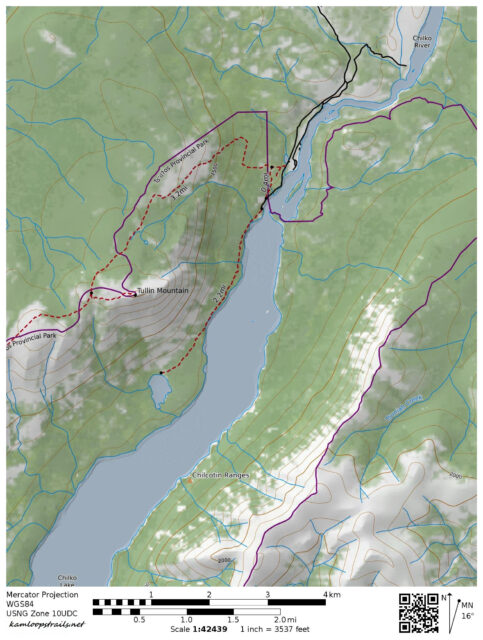
Tullin Mountain Trail – Kamloops Trails
A number of years ago we spent some time hiking in the Chilcotin. We drove many miles of backroads to get to the north end of Chilco Lake in Tsylos Provincial Park. At the end of the road we hiked up the Tullin MountainTrail to the summit.
The trail wound through the forest, climbing 832 m (2729 vertical feet) in about 6.3 km. The views were wide open at the top, making the long drive and long climb well worth our efforts.


Most of the views were to the south, looking into the sun, but we could see down to the lake too. ChilKo Lake is more than 60 km long, with the south end deep in the glaciated Coast Ranges.
 To the north, the Chilko River flowed northeast on its way to the confluence with the Chilcotin River.
 To the east, the Chilcotin Ranges stood above Chilko Lake.


Doug Smith
Doug writes for Kamloops Trails, a not-for-profit (and ad free) website, offering information on trails, waterways, routes, featured spots, viewpoints, and explorations in the outdoors in the Kamloops area (and beyond).
Doug started exploring this area in 1976 and continues to follow tracks and routes wherever they lead, with the aid of map, compass, GPSr and camera. After many dead-ends, but also many discoveries, he chose to share this information.
The Kamloops Trails website has a massive number of interesting posts and would be of interest to anyone in Kamloops who enjoys the outdoors. Visit the Kamloops Trails website at: http://www.kamloopstrails.ca/
My Blog Posts