Tranquille River Canyon in February
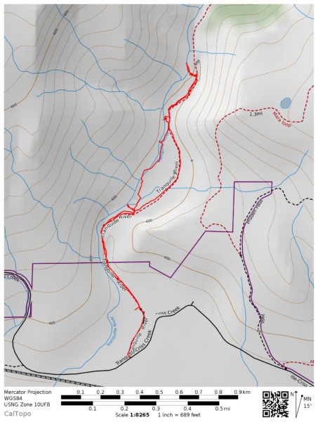
The Tranquille River Trail goes from the parking lot up past the old dam to where the canyon narrows down. Beyond that is all scrambling. Hikers can walk on the double track, then the single track for about 2.4 km before turning around to come back. there are routes that can be climbed on either side, but those are mostly scrambling or steep off-trail choices. On the main trail are many features to enjoy. Various formations stand out on both sides of the river valley.
On this last trip, I walked up the main trail on ice, mud, or snow, then took side routes out to the riverbank on the way back.
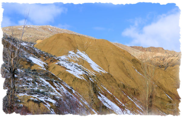
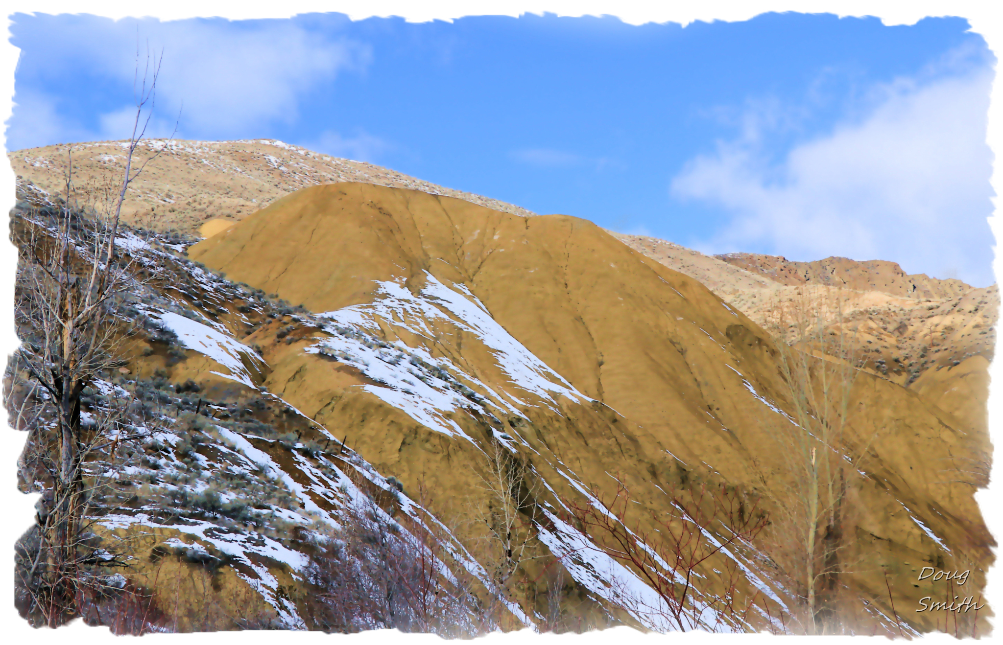
 Sunshine broke through the clouds, highlighting Tranquille Ridge and the Pimple.
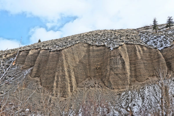
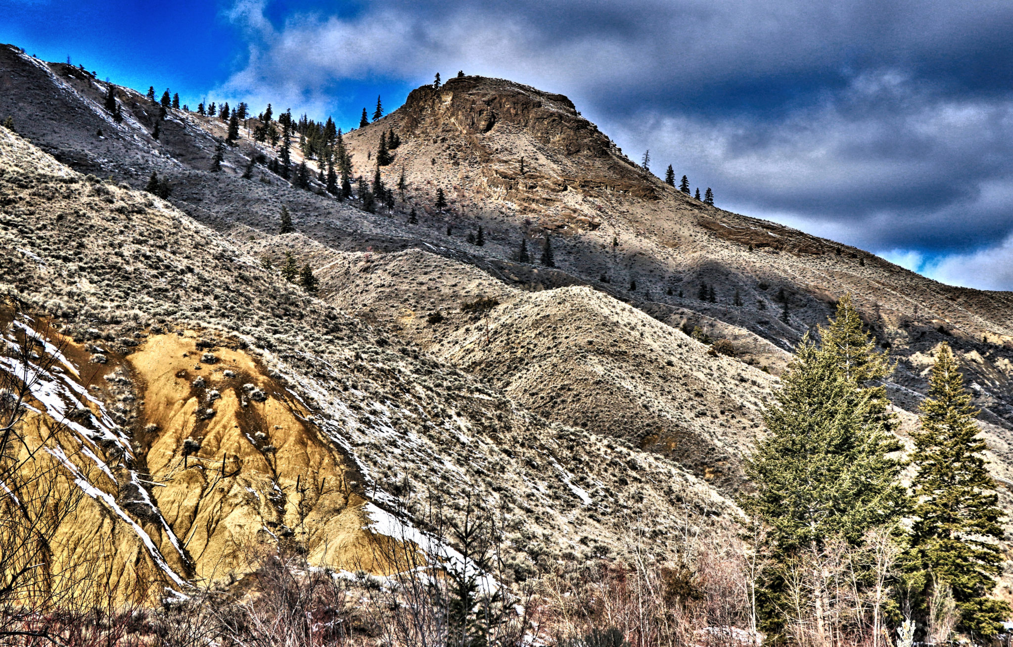 Farther up on the east side are a number of conglomerated cliffs, deposits left by the glaciers. There was constant rockfall at this feature on a mild day when the frozen ground is defrosting.
 The riverwas flowing freely through snow banks but there were some exposed ice sculptures where the river had eroded the overlying snow mass.
 The river is slowly removing the snow as the weather warms up. The main trail winds away from the river, so taking side trails is the best way get to viewpoints on the shoreline.
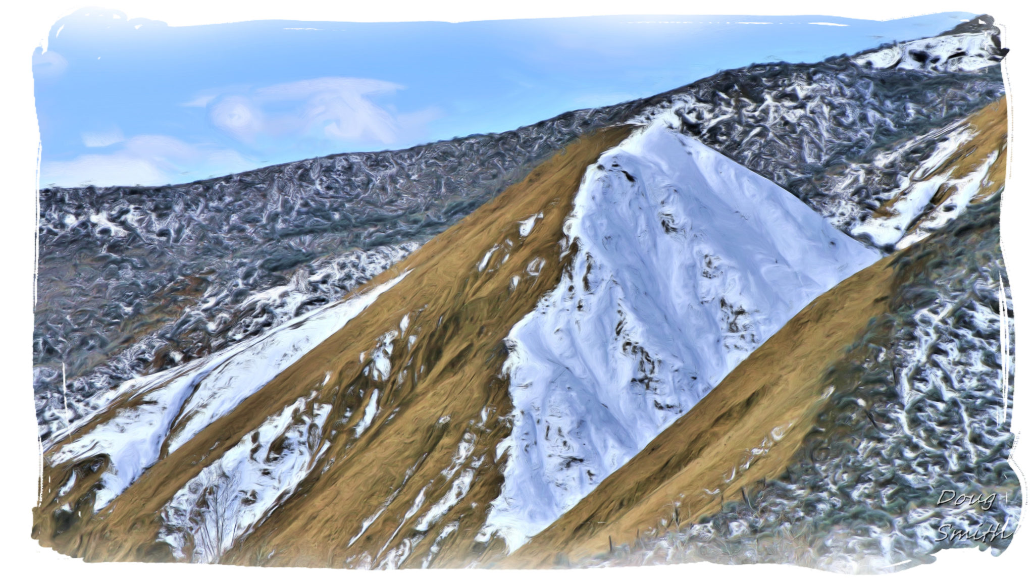
 The south-facing slopes were mostly clear of snow, but the sheltered or north-facing slopes were still covered in snow in late-February.
 In the upcoming weeks, there will be phases of muddy ground with snow lingering in sheltered spots, but it should be clear by the end of March, another fine time to visit the Tranquille River Trail.
Note – River or Creek?
The Federal Government is responsible for all official place names in Canada and are listed with geographic coordinates in the gazeteer. Officially it is the Tranquille River, but lots of people call it Tranquille Creek. On a BC Parks sign on the trail it is called a creek. Someone in Parks needs to look it up and get it right.
Doug Smith
Doug writes for Kamloops Trails, a not-for-profit (and ad free) website, offering information on trails, waterways, routes, featured spots, viewpoints, and explorations in the outdoors in the Kamloops area (and beyond).
Doug started exploring this area in 1976 and continues to follow tracks and routes wherever they lead, with the aid of map, compass, GPSr and camera. After many dead-ends, but also many discoveries, he chose to share this information.
The Kamloops Trails website has a massive number of interesting posts and would be of interest to anyone in Kamloops who enjoys the outdoors. Visit the Kamloops Trails website at: http://www.kamloopstrails.ca/
My Blog Posts