The Guardsmen and Panorama Point
Although we have hiked to the Guardsmen many times, we try to take a different route each time or to combine different detours, often taking an eclectic approach along the way. The Guardsmen are a number of large hoodoos standing over Tranquille River in a difficult-to-get-to spot of the rugged canyon. We started at the trailhead for the Mara Trail, taking the double track which is the Pruden Pass Road (sometimes called the Wheeler Mountain Road). We followed the track for 3.3 km, then turned left onto an older partly grown-over track bearing northwest. Before descending into the gully, we enjoyed the views north to Wheeler Bluffs (another good hike).  For this day, we chose a route that wound down into the gully at the foot of Ice Age eskers.
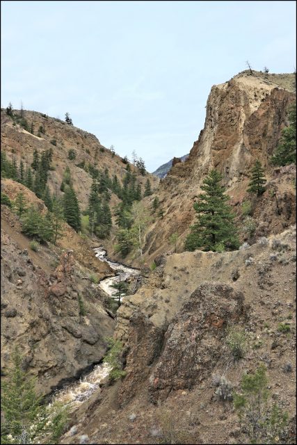
 We followed the gully down to the river. We were surprised by the volume of water surging through the canyon. In summer this is a quieter spot, with some riverside boulders to sit on. In late summer I have even scrambled upstream to the slot canyons, rock hopping most of the way, but this is not a recommended route. The Guardsmen are an impressive, rugged location.
 We scrambled up the steep, crumbly ridge, enjoying the views of the gorge.
  Higher up we could see south down the canyon. The hill due south was our next destination, Panorama Point.
  On the Panorama Point hill we had views north into the canyon and beyond to Wheeler Mountain and Opax Mountain.
  On our way back we contoured under the hill called Moby Dick (named by Roland Neave in Hiking the High Points). We have hiked over it, or up the gullies in the past, enjoying the lava flow features.
  We could see down into the Tranquille River area with light green cottonwood leaves on both sides of the river delta.
  We worked our way around the hills and back to the Pruden Pass Road, finishing the hike with a 2.5 km descent to the trailhead. The whole route was about 10.5 km. The area around The Guardsmen and Panorama Point are rugged and more difficult, but very scenic.
More Information:
Doug Smith
Doug writes for Kamloops Trails, a not-for-profit (and ad free) website, offering information on trails, waterways, routes, featured spots, viewpoints, and explorations in the outdoors in the Kamloops area (and beyond).
Doug started exploring this area in 1976 and continues to follow tracks and routes wherever they lead, with the aid of map, compass, GPSr and camera. After many dead-ends, but also many discoveries, he chose to share this information.
The Kamloops Trails website has a massive number of interesting posts and would be of interest to anyone in Kamloops who enjoys the outdoors. Visit the Kamloops Trails website at: http://www.kamloopstrails.ca/
My Blog Posts
