Sugarloaf Hill on a Cool Day
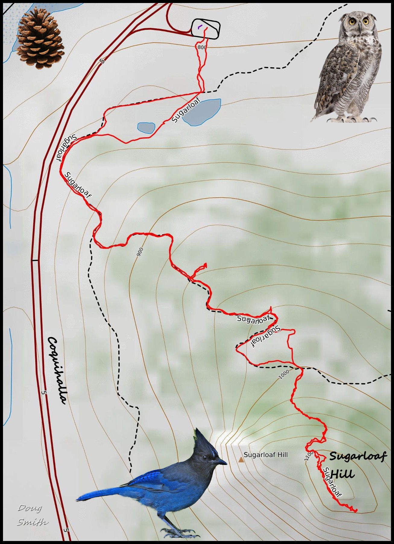
On a cool (-4C) November day we hiked up Sugarloaf Hill from the Coquihalla Highway pullout. Much of the route was on snow, but it was mostly sunny with just a little wind (except on the top). The lower part of the hike is a double track that winds up through grassland hills toward the upper forests. The hike climbs 400m in elevation over 3.5 km. The upper area is steep and forested.
The route follows double tracks on the west side of the hill running parallel to the Coquihalla.
 Viewpoints on the way up look north toward the Thompson River Valley. The upper part of the hill is on Crown land.
 The summit was snowy and cold, with some wind. Views extended south to the high country, east toward Rose Hill, and west toward Greenstone Mountain. The Inks Lakes had a layer of ice on the surface (2.6 km away).
 The out-and-back route was about 7 km, taking about 2.5 hours (inc. lunch).
The lower slopes are used for grazing, so we only do this route off season, usually in November or December, but it is a route we enjoy so we will back back in the late fall next year.

Doug Smith
Doug writes for Kamloops Trails, a not-for-profit (and ad free) website, offering information on trails, waterways, routes, featured spots, viewpoints, and explorations in the outdoors in the Kamloops area (and beyond).
Doug started exploring this area in 1976 and continues to follow tracks and routes wherever they lead, with the aid of map, compass, GPSr and camera. After many dead-ends, but also many discoveries, he chose to share this information.
The Kamloops Trails website has a massive number of interesting posts and would be of interest to anyone in Kamloops who enjoys the outdoors. Visit the Kamloops Trails website at: http://www.kamloopstrails.ca/
My Blog Posts