Ragged Red Ridge Reverse Route
The Ragged Red Ridge has no trail. It is a continuous ridge that rises from the Dewdrop Range to the upper rim of the Red Plateau Escarpment. The well-established Dewdrop Trail climbs up a gully, then a parallel ridge to the rim, a much easier route. We have climbed up the Ragged Red Ridge and have looped down the Dewdrop trail a few times, but on this early May day, we did the reverse route.
The Dewdrop Trail climbs for 3.7 km to the rim. There are a number of viewpoints on the way, mostly down to the Dewdrop Range and Kamloops Lake beyond.
The Ragged Red Ridge is on the west, a 500 m away.
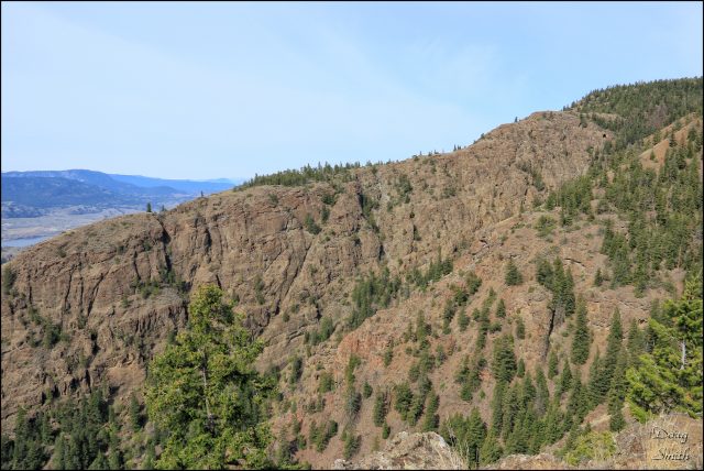
 At 4.7 km we stopped for lunch at the top of the Ragged Red Ridge, then we worked our way down the ragged volcanic cliffs. There is a good route up or down, but it is not always obvious.
 On top of the ridge there are open views to the west.
 The way down the ridge is rough, requiring scrambling and careful progress.
 The whole route is about 8 km, which took us 3.25 hours, a harder hike, but a rewarding one.
Relive ‘Ragged Red Ridge Reverse Route’

Doug Smith
Doug writes for Kamloops Trails, a not-for-profit (and ad free) website, offering information on trails, waterways, routes, featured spots, viewpoints, and explorations in the outdoors in the Kamloops area (and beyond).
Doug started exploring this area in 1976 and continues to follow tracks and routes wherever they lead, with the aid of map, compass, GPSr and camera. After many dead-ends, but also many discoveries, he chose to share this information.
The Kamloops Trails website has a massive number of interesting posts and would be of interest to anyone in Kamloops who enjoys the outdoors. Visit the Kamloops Trails website at: http://www.kamloopstrails.ca/
My Blog Posts