Porcupine Creek to Lime Ridge
The Porcupine Creek Trail starts at the Porcupine Creek Rec Site off a narrow and rough forest service road in the Marble Range. the rainy days of 2020 had taken its toll on the backroad. It was narrow and rough and a small slide had partly covered the road. Nearby the road is crumbling away and may fall into the creek valley after a good rainfall. The road needs to be closed until some major roadwork can be done. We got in with 4X4’s but we won’t do the road again. We parked and hiked up the trail all the way to the top of Lime Ridge.
 The Rec site is used by backcountry horse riders and seemed to be in good shape.
 The trail follows a branch of Porcupine Creek for 3 km in a forested gully, climbing steadily.
 This is a favorite trail, moderate in its grade, working its way up to an old burn.
 A the top of the valley, the trail then switchbacked up through a whitebark pine forest that was burned in 2003.

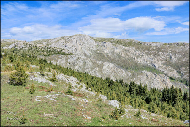
The trail disappears when it reaches the top of Lime Ridge. The open karst ridges stretch for 8 km and there are several route choices. For this day, we hiked northwest along the ridge, paralleling the Jesmond Road.
 To the northeast was Wild Horse Ridge and Mt. Kerr. We have hiked that route too.
 In the far west, the Camelsfoot Range rose above the Interior Ranges 27 km away.
 Below the steep slopes of Lime Ridge angled down through the burn with the Jesmond Road at the bottom of the valley and the Edge Hills on the other side. The Fraser River is far below the Edge Hills, only 2.4 km from Lime Ridge, but a descent of 2000 m.
  The top of Lime Ridge is a desolate limestone ridge.
 But there were many low-growing plants on this windswept ridge – white mountain avens, starwort, stonecrop, jacob’s ladder, mountain arnica, and a favorite, moss campion.
 We returned the way we came, across the ridge, down through the burn, down the creek valley, and along the old double track to our trucks, a 10 km hike in the Marble Range. We will be back in 2021 to do another hike in the area.
Doug Smith
Doug writes for Kamloops Trails, a not-for-profit (and ad free) website, offering information on trails, waterways, routes, featured spots, viewpoints, and explorations in the outdoors in the Kamloops area (and beyond).
Doug started exploring this area in 1976 and continues to follow tracks and routes wherever they lead, with the aid of map, compass, GPSr and camera. After many dead-ends, but also many discoveries, he chose to share this information.
The Kamloops Trails website has a massive number of interesting posts and would be of interest to anyone in Kamloops who enjoys the outdoors. Visit the Kamloops Trails website at: http://www.kamloopstrails.ca/
My Blog Posts