On the Orchard Lake Trails
The Orchard Lake Trails are backcountry horse trails in the Sullivan Range. They are accessed from the Badger Creek Forest Service Road, which starts 16.5 km north of Heffley Creek on Highway 5 (North). Most of the “trails” are double tracks through the forest, passing small lakes and forested ridges, but increasingly the area has also been logged. Routes on the trail system have horseshoe signs on them, but hikers would need to carry a map to stay on track. I have hiked all the trails in the area, combining various tracks to create loops. On this last fall venture, I started at the highest point of the trails near Coyote Lake and did an 11.75 km route.
I hiked past Coyote Lake and ran into a large number of grazing cows so I opted to go off trail, climbing over a ridge to avoid the congestion.
The area between Coyote Lake and Orchard Lake is at an elevation of 880m down to 780m, a douglas fir forest with deciduous trees in the creek and stream gullies. The wide valleys have been logged leaving grasslands and shrub growth
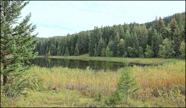
 Orchard Lake is at the north end of the Sullivan Valley. Ranches extend for 10 km south of the lake, past Huff Lake, then Lyons Lake.
 From Orchard Lake I hiked north along a double track past Chalforchie Lake.
 This is the nicest part of the trail system, the middle section passing quiet lakes.
 At the north end of the lake, I got back on well-used double tracks, and climbed to the lower Coyote Lake (really a big pond), then back to the upper Coyote Lake to complete a large loop route.
 The map of the trails has been widely shared by neighbouring communities and it is featured in the BC Backroads Mapbook for the area, but it is now out-of-date. The lower end of the trails and the hills in the western Sullivan Range have been logged. There are some new fences (grazing leases) in the south end of the map. If anyone chooses to hike the trails, they can start at #1 (or higher up the road) and go to #3, then #4, then #5 and back by Chalforchie Lake, still a nice route, especially in the fall.

29/10/20/DAS
Doug Smith
Doug writes for Kamloops Trails, a not-for-profit (and ad free) website, offering information on trails, waterways, routes, featured spots, viewpoints, and explorations in the outdoors in the Kamloops area (and beyond).
Doug started exploring this area in 1976 and continues to follow tracks and routes wherever they lead, with the aid of map, compass, GPSr and camera. After many dead-ends, but also many discoveries, he chose to share this information.
The Kamloops Trails website has a massive number of interesting posts and would be of interest to anyone in Kamloops who enjoys the outdoors. Visit the Kamloops Trails website at: http://www.kamloopstrails.ca/
My Blog Posts