McAbee Hills Ramble – Kamloops Trails
The Cache Creek Hills extend from the Back Valley Road, just each of Cache creek, to the Battle Creek FSR close to Juniper Beach Provincial Park. A series of open hills rise 2500 feet above the TransCanada Highway. There are no established trails in the hills, but there are some tracks from The Back Valley Road, the Battle Creek FSR, or the highway that lead up into the hills. Hikers have to be mindful of restricted areas – private ranch lands, the McAbee Heritage Site, and homes along the Back Valley Road. There are also grazing leases in the hills (be respectful of fences and posted signage) and so we choose to hike the area off-season (esp. late fall) when there are no cattle grazing. I spotted motorcycle and quad trails on my last hike into the hills. A small number of hikers have a very small impact compared to motorized users, especially when we practice “Leave no Trace” exploration. In the last venture into the hills, I started near the McAbee Heritage Site, but I veered west, following tracks that climbed the ridges, then traversed across hills and gullies toward the Battle Creek FSR, descending to an area east of McAbee and back.

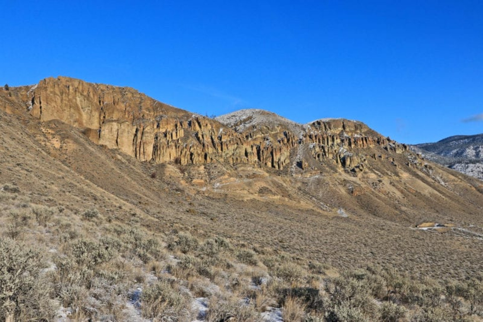
Since the McAbee Heritage Site is closed to visitors, I steered west, climbing ridges around the rugged cliffs.
 Once I reached a point well above the McAbee site, I was able to head north and east across open hills. To the northeast, across Battle Creek, the hills are higher and more rugged, rising to 4900 feet. The upper hills are forested and trackless.
 contImmediately north ridges and gullies rise to the tops of the hills with little tree cover on the south-facing slopes. The next hike will be over to the top of Rattlesnake Hill.
 The snow was deeper as I climbed higher, covering the bunchgrass clumps on the hills.
 A deep gully cut the route on the east side of these hills and the best route is a large loop around the top of the gully, adding 2 km to the route. Any shorter route requires a steep descent (on snow at this time of the year.
 Near the end of the loop route I crossed some excavations from the McAbee area (east of the site) that were made prior to the heritage designation. Fossils can be found in the layers at the same elevation across these hills, but the area is now restricted to the public. I detoured around the heritage site back to the highway.
 I scared up a flock of chukar in the last section of the hike. Tracks were clear in the snow.
 There will be more days of hiking up to the tops of the Cache Creek Hills in late fall and early spring. With very few trees and a south exposure these hills will be hot and exposed in late spring and summer. The area reminds me of the Dewdrop Range which has provided many good routes over the years.
Doug Smith
Doug writes for Kamloops Trails, a not-for-profit (and ad free) website, offering information on trails, waterways, routes, featured spots, viewpoints, and explorations in the outdoors in the Kamloops area (and beyond).
Doug started exploring this area in 1976 and continues to follow tracks and routes wherever they lead, with the aid of map, compass, GPSr and camera. After many dead-ends, but also many discoveries, he chose to share this information.
The Kamloops Trails website has a massive number of interesting posts and would be of interest to anyone in Kamloops who enjoys the outdoors. Visit the Kamloops Trails website at: http://www.kamloopstrails.ca/
My Blog Posts