Jesmond Lookout Hike – Kamloops Trails
We did a summer basecamp at Big Bar Lake Provincial Park and hiked in the Marble Range and paddled the lake. One of the hikes we did was to the top of the Marble Range at the Jesmond Lookout. From the Jesmond Road near the junction of the Big Bar Ferry Road, we turned onto the Jesmond Forest Service Road and drove 3.8 km to the junction with the start of the summit road. We parked and hiked up the double track.
 The road can be driven by most vehicles for about half the distance. The upper part is high clearance and one section is better suited to 4WD. The route winds through the forest until the last kilometer.
 Wildflowers were blooming along the route, but were more numerous in the subalpine meadows near the top.

pale agoseris
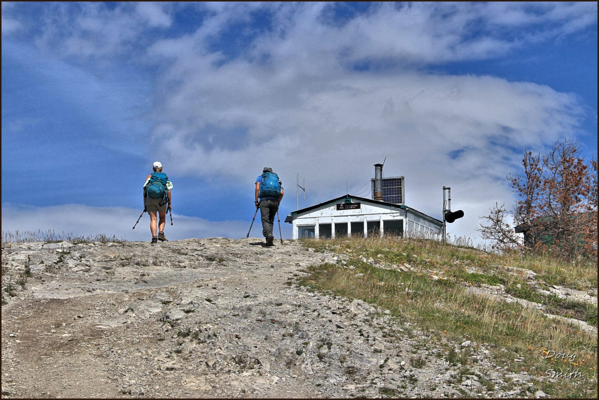
The final part of the hike is a bit steeper, but it opens up to provide fine views.
 The fire lookout tower is in good shape. It was built in the early 1970’s and used from 1972 to 1999. “The lookout tower was staffed with an observer during the fire season, which was typically from early May to late September. An average of 12 wildfires per year were detected over these years. The observer was generally posted at the lookout for 3 weeks at a time, living inside the lookout tower.” (BC Rec Sites and Trails)
 The location is on top of the last hill on the north end of the Marble Range, a great viewpoint. We could see across the Cariboo to the north.

Meadow Lake
Big bar Lake lay below us to the northeast. Green Lake lay in the distance to the east. The road/canyon down to the Big Bar Ferry on the Fraser River was on the west.
 To the west in the distance the Camelsfoot Range towered above the Fraser hills.
 The hike up and back from the bottom was about 10 km. With a good double track we made good time on a pleasant summer day.
Doug Smith
Doug writes for Kamloops Trails, a not-for-profit (and ad free) website, offering information on trails, waterways, routes, featured spots, viewpoints, and explorations in the outdoors in the Kamloops area (and beyond).
Doug started exploring this area in 1976 and continues to follow tracks and routes wherever they lead, with the aid of map, compass, GPSr and camera. After many dead-ends, but also many discoveries, he chose to share this information.
The Kamloops Trails website has a massive number of interesting posts and would be of interest to anyone in Kamloops who enjoys the outdoors. Visit the Kamloops Trails website at: http://www.kamloopstrails.ca/
My Blog Posts