Hiking to Skoatl Point – KamloopsTrails
On a September morning I drove the backroads (Westsyde Road > Jamieson Creek Road > Windy Lake Road > Skoatl Point Road) to the trailhead for Skoatl Point. I hiked through the black forests to the top of Skoatl Point. The whole area was burned in the Sparks Lake Fire of 2022. The road is long (37.5 km), bumpy, and grown-in. The trail winds through fireweed, tall pinegrass, and black stumps to Adler Lake. The small damper area around the lake was not burned, but there were many fallen trees to go over, under, or around. The windfall was cleared this spring, so we can hike all the way to Skoatl Point and back now.

There are a few flags to help with the route and a few hikers have made most of the way obvious. The blackened trees are becoming whiter as the burned bark falls away. The first section of the trail is about 2 km, an up and down route, then descending to Adler Lake.

From the south end of the lake we get our first glimpses of Skoatl Point. The trail winds along the western side of the lake.

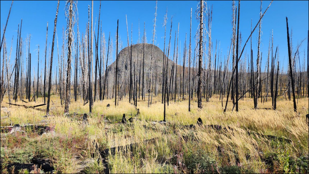
From the end of Alder Lake, the trail climbs back through a burned area. The volcanic plug ahead is the core of an ancient volcano. The cone has eroded away and all that is left is basalt, sheer on 3 sides. The hiking route climbs to the southeast corner.

To get to the top we have to scramble up the basalt blocks, winding to find the best blocks. It is steep route, requiring care. Since I was hiking solo, I took my time, following a route I had done before.

From the top of the hill, we have wide views across the Bonaparte Plateau. Dagger Lake lies north and Bonaparte Lake is in the trench farther north.

There are dozens of lakes visible from the rim. Not much grows on top – one small bonsai-type tree and a few hardy perennials (saxifrage and sedum). We walk across the tops of basalt columns on the top of Skoatl Point.
A few images are shared here. Click an image for a lightbox view and a caption.


This was an out-and-back route. On this day, there was no one else in the area. I spotted some birds and squirrels, but it was quiet in this remote part of our area.
Doug Smith
Doug writes for Kamloops Trails, a not-for-profit (and ad free) website, offering information on trails, waterways, routes, featured spots, viewpoints, and explorations in the outdoors in the Kamloops area (and beyond).
Doug started exploring this area in 1976 and continues to follow tracks and routes wherever they lead, with the aid of map, compass, GPSr and camera. After many dead-ends, but also many discoveries, he chose to share this information.
The Kamloops Trails website has a massive number of interesting posts and would be of interest to anyone in Kamloops who enjoys the outdoors. Visit the Kamloops Trails website at: http://www.kamloopstrails.ca/
My Blog Posts