Dewdrop Ridge in the Fall
I hiked up the hillside to the south of Frederick Road and explored the cliffs, basalt columns, gullies, and viewpoints overlooking Battle Bluff and Kamloops Lake. I parked at the first pullout on the right (before the Dewdrop Trail parking area) and crossed the flats, then angled up the hill. There is no trail, but the slopes are open grasslands or open forest. Looking back to the north, the top of Jag Hill was wreathed in foggy cloud layers.
 As I approached the top of the ridge a small herd of rams was grazing. They kept an eye on me as I quietly continued my climb to the southeast corner of the ridge.
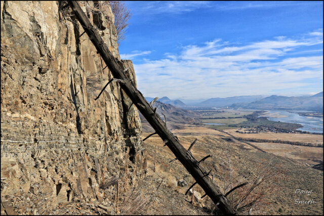
 At the viewpoint there was a clear view up the Thompson River to Kamloops. Below was Cooney Bay and the floodlands at the mouth of the river. I scrambled down the steep slope to the east end of the foot of the basalt bluffs.
 The Dewdrop Range is built on volcanic flows from Red Plateau. Under the cliff tops of Dewdrop Ridge are a series of basalt column cliffs. I hiked/scrambled along the foot of the cliffs heading west.
 Growing out of the cracks in the columns are a few shrubs, herbs, and small trees.
 I dropped down from the upper row of basalt columns onto a lower ridge and along the top rim of a lower set of basalt columns, the ones visible from Battle Bluff. There is a faint single track along the rim as it curves in a northwest direction. Directly above was another shorter set of columns. I scrambled up a gully back to the upper rim, a route used by bighorn sheep and deer, well-used with many animal tracks.
 I continued along an informal trail on the rim back to where I came up from below. The Red Plateau Escarpment rose for 700 m (2300 vertical feet) above the Dewdrop Range (plateau).
 I followed the open slopes down Dewdrop Ridge to the parking area, the end of a favorite hike in the Kamloops area. There are no trails to follow and some of the route is rough, requiring light scrambling, and good navigation.
More Information:
Doug Smith
Doug writes for Kamloops Trails, a not-for-profit (and ad free) website, offering information on trails, waterways, routes, featured spots, viewpoints, and explorations in the outdoors in the Kamloops area (and beyond).
Doug started exploring this area in 1976 and continues to follow tracks and routes wherever they lead, with the aid of map, compass, GPSr and camera. After many dead-ends, but also many discoveries, he chose to share this information.
The Kamloops Trails website has a massive number of interesting posts and would be of interest to anyone in Kamloops who enjoys the outdoors. Visit the Kamloops Trails website at: http://www.kamloopstrails.ca/
My Blog Posts