Clay Lake – Griffin Lake Ramble
In every month of the year there are interesting routes that start in the Lac du Bois Nature Conservancy. On a sunny day in early September we struck off through the tall grasses toward Clay Lake. A faint single track route goes over to the end of Clay Lake, but it was mostly grown over with snowberry shrubs and windfall. We worked our way along the shore of Clay Lake to the edge of the meadows.

On the shore of the lake is the Joe Reid Homestead (1912 – 1918). He and his wife lived there for 6 years. All of the homesteaders tried farming and logging, but he was mainly a trapper.
 Across Clay Lake is the McQueen Lake Day Center. Clay Lake is a scenic spot all year-round.
 Across the pastures is Meadow Pond. The Grasslands Community Trail goes along the north side of the pond.
 We followed the trail to Griffin Lake, turning onto the Orange Trail to the northeast corner of the lake. The J. Brown homestead (1914 – 1923) is still standing.
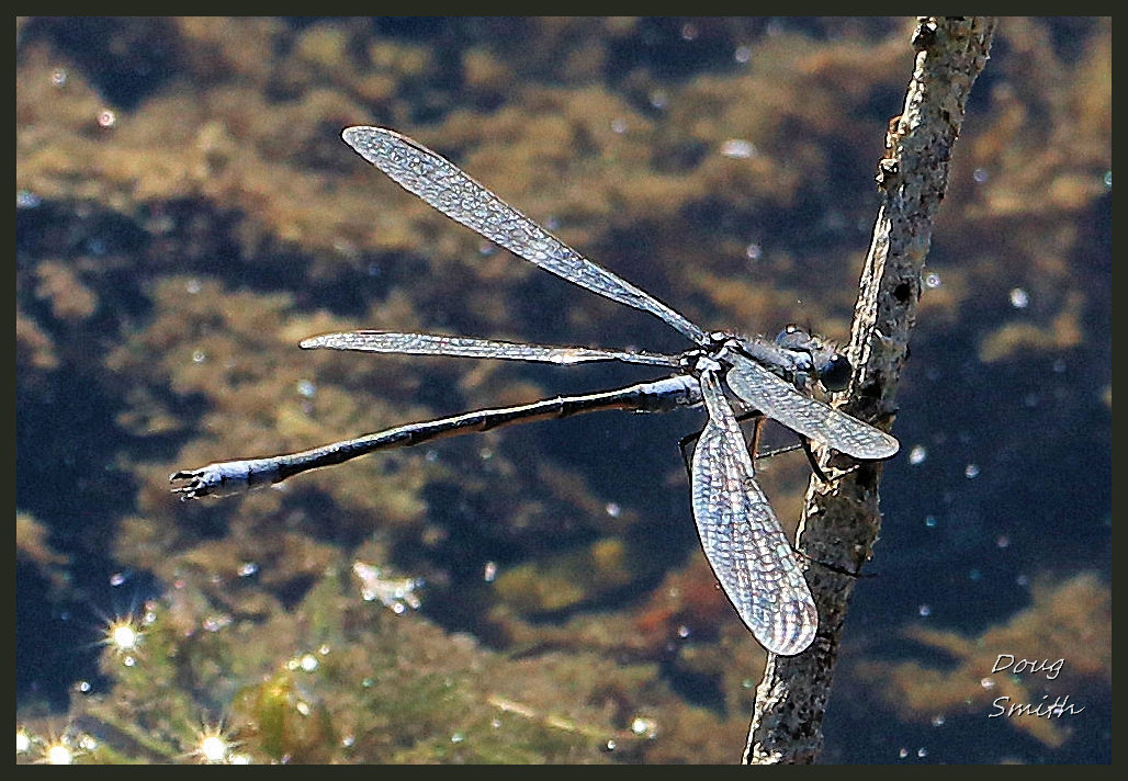
 During a lunch break, I wandered along the shoreline watching dragonflies and pond creatures in the shallow areas.
 We rounded the end of Griffin Lake and continued along the Orange Trail. As we approached the McQueen Lake area, we turned south to follow trails across McQueen Creek, careful to avoid going into the McQueen Lake Environmental Education Center which does not want visitors when children are present. No Trespassing signs should be respected. School had not yet started and in a Covid year, overnight stays were not in the plans, but we respectfully avoided the area anyway.
 We followed McQueen ski trails south back to the start, a 7+ km route. On the way back I stopped to check out some of the ponds in the grasslands, now surrounded by fall colors.
 We will be back mid-winter to snowshoe in the Lac du Bois Nature Conservancy hills…
Directions:
- There are no trail signs and in the fall, many of the single and double tracks are grown over so it is hard to find the route noted above
- You can use a map and compass or a GPS to find a way to Clay Lake and then over to the McQueen Lake Trails, but you need to use navigation skills to be in touch with the map and proposed route.
- The McQueen Lake trail system has colored signs to help but they no longer provide access to trail maps (there are legacy maps on this website that can be found with the Search bar though).
Doug Smith
Doug writes for Kamloops Trails, a not-for-profit (and ad free) website, offering information on trails, waterways, routes, featured spots, viewpoints, and explorations in the outdoors in the Kamloops area (and beyond).
Doug started exploring this area in 1976 and continues to follow tracks and routes wherever they lead, with the aid of map, compass, GPSr and camera. After many dead-ends, but also many discoveries, he chose to share this information.
The Kamloops Trails website has a massive number of interesting posts and would be of interest to anyone in Kamloops who enjoys the outdoors. Visit the Kamloops Trails website at: http://www.kamloopstrails.ca/
My Blog Posts