Castle Butte Ramble – Kamloops Trails
Castle Butte is a promontory/ridge that juts out from the Red Plateau Escarpment. To get to the top of the hill at the end of the ridge, a ledge is followed to the east side then a short scramble is required to go the south end of the butte. Most hikers who choose to go to Castle Butte follow the Dewdrop Trail from the Dewdrop Range Trailhead. That trail climbs 681m (2234 vertical feet) over 5.7 km for a 11.4 km challenging hike. We know a route from the Rd Plateau Forest Service Road, though, that climbs only 190m over 3.2 km with some moderate up and down along the route. It follows old double tracks on Red Plateau and meets the Dewdrop Trail at the edge of the escarpment. Navigating this area is not easy. There are a number of turns to take and even experienced hikers can find themselves going the wrong way. Some coordinates are provided below for anyone wanting to try the route using a GPS.
I have been hiking on top of the plateau for about 30 years so I know the routes well. On this day, we started by driving up the Red Plateau FSR from the Tranquille – Criss Creek Road. At the 4.5 km mark, we parked on the side of the road just past an old track on the left. We hiked along that track until it comes to a clearing (a confusing spot for some). There is a volcanic vent on the right and the double track to take is on the other side of the vent depression. We followed that track uphill, then down past ponds. Not far past a marshy area a BC Parks sign stands on the left and another double track bears south at that point. This track goes up the hill and meets the signed Dewdrop Trail.
 At that junction, I went right (west) following the Dewdrop Trail as it skirts the rim of the Escarpment.
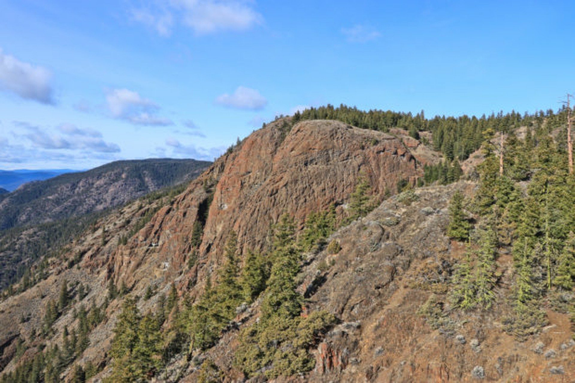
 There is no signage at any of the landmarks along the Dewdrop Trail, but at an obvious ridge with the reddish wall in view to the west, the route (no trail) bears south. A rough route of 0.5 km goes downhill to Castle Butte. At a spot below reddish cliffs, the route is around to the left on ledges. To get to the top, a short scramble is required. The end of the route is at the top of the cliffs on the south side.

From this viewpoint we can see west down Kamloops Lake.

To the southeast below is the Dewdrop Range. Battle Bluff is the black hill sticking out toward Kamloops Lake.


We scrambled back down then around the ledge past orange crustose lichens on the cliffs back to the ridge. We hiked back up to the Dewdrop Trail and followed our route back to the trailhead.

A small partly-frozen pond is passed on the route back, reflecting in the afternoon sun.

The return hike is about 7.1 km taking 2.5 hours. We did this in fall when a bit of mud and some puddles are on the road in and the route, but it was quiet and scenic, a route to return to for many more years.

More Information:
Doug Smith
Doug writes for Kamloops Trails, a not-for-profit (and ad free) website, offering information on trails, waterways, routes, featured spots, viewpoints, and explorations in the outdoors in the Kamloops area (and beyond).
Doug started exploring this area in 1976 and continues to follow tracks and routes wherever they lead, with the aid of map, compass, GPSr and camera. After many dead-ends, but also many discoveries, he chose to share this information.
The Kamloops Trails website has a massive number of interesting posts and would be of interest to anyone in Kamloops who enjoys the outdoors. Visit the Kamloops Trails website at: http://www.kamloopstrails.ca/
My Blog Posts