Above Gibraltar Rock – Kamloops Trails
The main trail system in Paul Lake Provincial Park links the lake trails to Gibraltar Rock and the campground. But the west end of the park has a long steep ridge that can be hiked on an unsigned single track trail. The hike from the lakeshore to the top of Gibraltar Rock, then up to the top of the ridge and back through the campground is about 8.5 km.
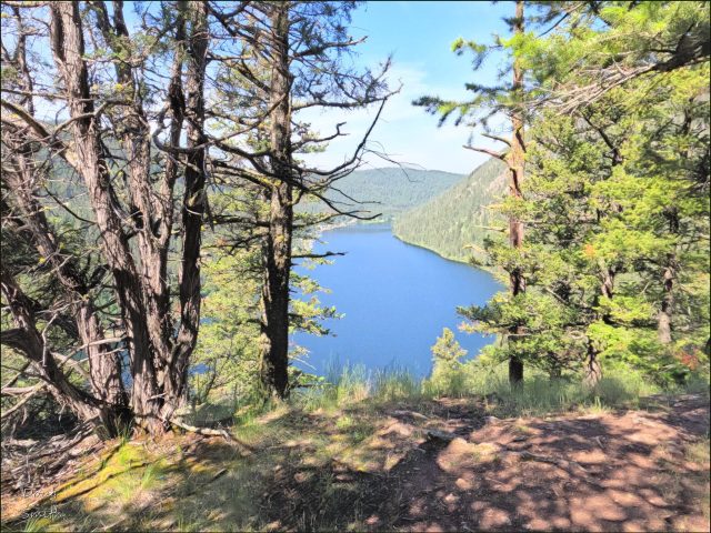
The trail up the western ridge is a user-made single track, flagged and has some cairns, but still requires some navigation. It winds up through the pinegrass and open douglas fir forest to the top of the ridge. It is a steep route best suited to spring or fall weather.

The best viewpoint is on the southwest corner, a little lower than the summit. Gibraltar Rock is 266 m lower (872 feet) lower and 1.6 km away.

Some video along the route is shared here:
More Information:
- The trail junction for the ridge route is at N50 44.609 W120 07.631
- The southwest viewpoint is at N50 44.538 W120 09.016
- Paul Lake Trails info – link
- An early post (2011) on this route – Louis Ridge

Doug Smith
Doug writes for Kamloops Trails, a not-for-profit (and ad free) website, offering information on trails, waterways, routes, featured spots, viewpoints, and explorations in the outdoors in the Kamloops area (and beyond).
Doug started exploring this area in 1976 and continues to follow tracks and routes wherever they lead, with the aid of map, compass, GPSr and camera. After many dead-ends, but also many discoveries, he chose to share this information.
The Kamloops Trails website has a massive number of interesting posts and would be of interest to anyone in Kamloops who enjoys the outdoors. Visit the Kamloops Trails website at: http://www.kamloopstrails.ca/
My Blog Posts