Zoa Peak Hike – KamloopsTrails
At the end of the first week of October I drove down the Coquihalla Highway to the Coquihalla Summit Recreation Area (2 hours drive) and turned at the Falls Lake Road to go to the trailhead for Zoa Peak. It was sunny and warm and because on an early start, I was the first on the mountain trail. The trail is signed as it follows a pipeline track, turns up through an alder corridor, and then follows the upper track to the Zoa Mountain Trail. The first 1.2 km climbs 355m (1165 ft.). Some fall colour along the open track makes this a good fall hike.

The trail climbs above Falls Lake (which is out of sight) between Thar Peak and Zoa Peak. Thar can be hiked, but its a very steep route.

The next kilometer winds up the southeastern ridge though the forest and through some small meadows.

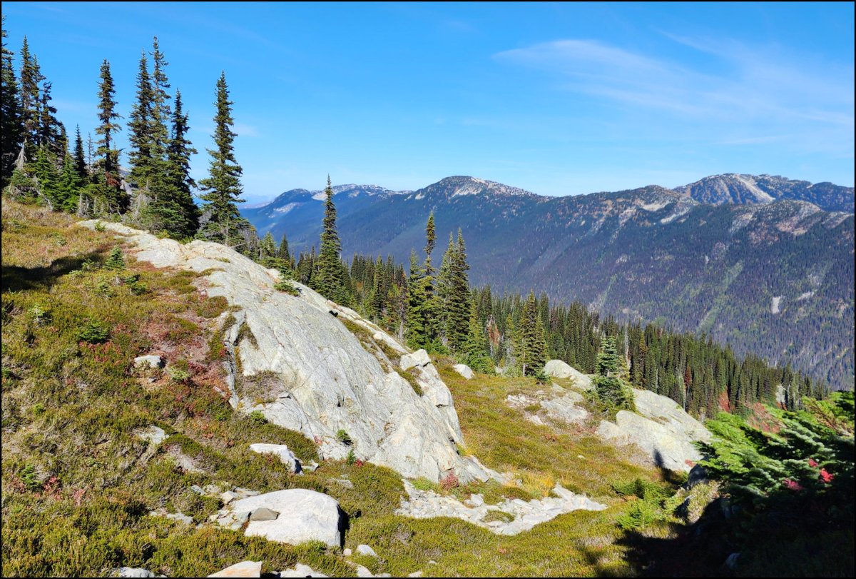
The trail winds out to the eastern side overlooking the Upper Coldwater River Valley. There was snow on the trail in the sheltered areas on top.

The trail ends at a viewpoint. We could an see west to Guanaco, Vicuna, and Alpaca Peaks (we have hiked these too). Beyond the Coquihalla Summit Peaks are the rocky horns of the Anderson Range.

There is a short side trail which provides a view of the north side of Yak Peak (we have hiked this too).

The Zoa Peak Trail is an out-and-back trail. The 9k route will take about 3- 4 hours. There are some steeper sections, but on the whole it is the most accessible and moderate of all of the Coquihalla Summit peaks.

We hike Zoa Peak most years in the fall. It is sometimes the last peak we summit before winter snows set in. We hope to do it again in the next year.
There are several more articles, maps, and images on this website. Use the Search Bar for more information.
Doug Smith
Doug writes for Kamloops Trails, a not-for-profit (and ad free) website, offering information on trails, waterways, routes, featured spots, viewpoints, and explorations in the outdoors in the Kamloops area (and beyond).
Doug started exploring this area in 1976 and continues to follow tracks and routes wherever they lead, with the aid of map, compass, GPSr and camera. After many dead-ends, but also many discoveries, he chose to share this information.
The Kamloops Trails website has a massive number of interesting posts and would be of interest to anyone in Kamloops who enjoys the outdoors. Visit the Kamloops Trails website at: http://www.kamloopstrails.ca/
My Blog Posts