In the Uplands Hills – Kamloops Trails
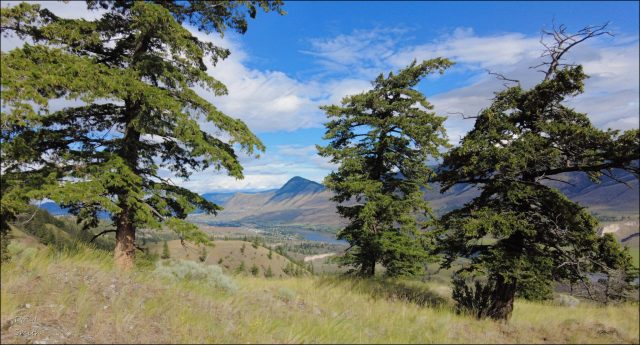
There are a number of trails off the end of McLeod Drive – Uplands Drive. Some are single tracks on the grasslands bench and some climb the steep rocky hills above. On a mild July day, I hiked two of the Uplands Hills to enjoy the forest, ridges, and viewpoints.
The trailhead area follows the gasline track west. A single track climbs south between two of the hills and then there are a number of forks to choose from. The one to the upper right goes to a hill I call Altius Hill, an open hilltop under a rocky cirque of Sunrise Mountain.

From the top there are fine views down the South Thompson River Valley.
 There are also viewpoints to the north and to the east with a little bit of extra hiking.
I returned the way I came, but then did a loop route on a lower ridge overlooking the grasslands bench. The whole hike was only 4.3 km, but with some steep sections. There are more routes and hilltops to explore, so I will be back again for another day of hiking in the Uplands Hills.

More Information:
- Park at the end of Uplands – McLeod Drive in Barnhartvale
- The trail into the hills is at N50 39.631 W120 11.998
- The Altius Hill viewpoint is at N50 39.389 W120 11.794
- Uplands Trails page
Doug Smith
Doug writes for Kamloops Trails, a not-for-profit (and ad free) website, offering information on trails, waterways, routes, featured spots, viewpoints, and explorations in the outdoors in the Kamloops area (and beyond).
Doug started exploring this area in 1976 and continues to follow tracks and routes wherever they lead, with the aid of map, compass, GPSr and camera. After many dead-ends, but also many discoveries, he chose to share this information.
The Kamloops Trails website has a massive number of interesting posts and would be of interest to anyone in Kamloops who enjoys the outdoors. Visit the Kamloops Trails website at: http://www.kamloopstrails.ca/
My Blog Posts
