To Garibaldi Lake – Kamloops Trails
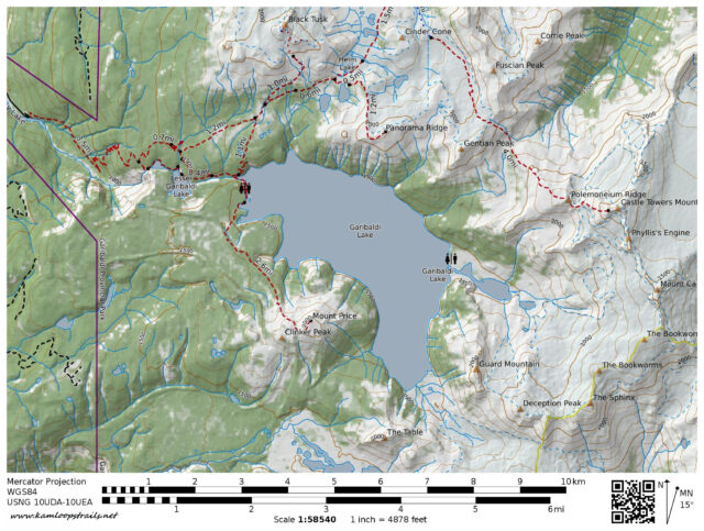
In a time before digital cameras we backpacked up to Garibaldi Lake on a sunny summer day. In the first day, we hiked up the 7.5 km trail through the forest, up the switchbacks, and along Rubble Creek toward the lake.
The trail wound up to the top of The Barrier, a lava dam which is responsible for the creation of Garibaldi Lake.

Rubble Creek drains Garibaldi Lake through Lesser Garibaldi Lake and Barrier Lake before tumbling over the Barrier down to Daisy Creek.
 The last half kilometer follows an arm of Garibaldi Lake toward the shores of the lake and the campground.
 Across the lake glaciers glaciers line the east and south sides of the lake.
 Battleship Islands are volcanic isthmuses in the bay. In our first time backpacking to the lake (in 1969), we camped on the islands.
 On this backpack, we set up camp in the new campground on the hillside. Later in the afternoon, we hiked up to viewpoints on the Mt. Price side of the lake. We got our first sight of The Black Tusk for that trip.
 To the south was Mt. Price with Clinker Peak on the right. On previous trips, I had hiked to the top of the mountain and beyond to the Table.
 At the end of the day, we had dinner looking across the lake to Castle Towers Mountain, Mount Carr, and the Sphinx.
 On the second day of this backpack trip, we hiked to the top of Panorama Ridge and beyond to Gentian Peak (a post to follow). In other trips we have hiked to the top of Black Tusk (three times), around the lake to Sphinx Bay and Sphinx Glacier, over the top of Mt. Price to Table Meadows and down Culliton Creek, and across Helm Glacier to Helm Peak. Most of these trips were between 1970 and 2003, memories now, but vivid ones.

Doug Smith
Doug writes for Kamloops Trails, a not-for-profit (and ad free) website, offering information on trails, waterways, routes, featured spots, viewpoints, and explorations in the outdoors in the Kamloops area (and beyond).
Doug started exploring this area in 1976 and continues to follow tracks and routes wherever they lead, with the aid of map, compass, GPSr and camera. After many dead-ends, but also many discoveries, he chose to share this information.
The Kamloops Trails website has a massive number of interesting posts and would be of interest to anyone in Kamloops who enjoys the outdoors. Visit the Kamloops Trails website at: http://www.kamloopstrails.ca/
My Blog Posts