Hiking Rabbit Island in March
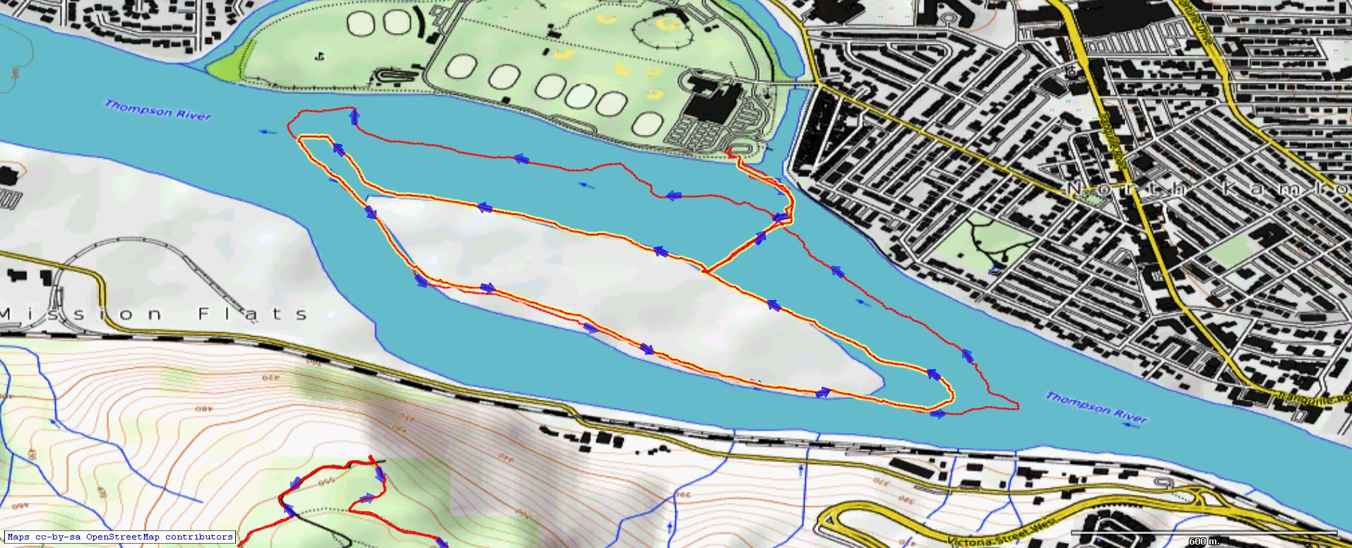
At the end of winter the rivers are at their lowest flow, so wide beaches and gravel bars appear, providing new areas to walk and hike. The beaches around Rabbit Island double the island’s size at this time of year and only a narrow channel of flowing water separates McArthur Island from Rabbit Island. From past experience I knew that the narrowest spot is only about knee deep and only about 30 – 40 steps across, but the water is cold so some planning helps to make the crossing comfortable. I have neoprene boots and a dry suit so I put those on at the channel’s edge, crossed over, then removed them on the other side. I was dry for my hike around the island, a 4.5 km loop.
The fine sand of the island makes one of the best beaches in the area, but access is limited to a channel crossing at low water or boat access at high water. I walked the sands to the south end of the lake first.
 At the south end of the island the river widens toward the delta and Kamloops Lake.
 The high part of the island itself is owned by Domtar, but that is only above the high water mark, and much of the island is inundated with floodwaters during freshet in June and July. When I hike the island, I try to stay on the beaches or higher at the edge of the high water mark.
 Most of the island is open grassland on floodwater sediments with cottonwoods and some shrub growth.
 There is a large beach at the east end of the island extending upriver too.
 The hike over to the island then a circuit around the island is about 5.2 km, taking about 1.5 hours, but a stop on the beach to have some tea is a “requirement” so plan for two hours. When the water warms up more, it will be possible to cross in water shoes, but the window of opportunity will be short once the snows melt in the mountains and the river rises.
I will be back to paddle around the island in June, then back to hike around the island next March.
Doug Smith
Doug writes for Kamloops Trails, a not-for-profit (and ad free) website, offering information on trails, waterways, routes, featured spots, viewpoints, and explorations in the outdoors in the Kamloops area (and beyond).
Doug started exploring this area in 1976 and continues to follow tracks and routes wherever they lead, with the aid of map, compass, GPSr and camera. After many dead-ends, but also many discoveries, he chose to share this information.
The Kamloops Trails website has a massive number of interesting posts and would be of interest to anyone in Kamloops who enjoys the outdoors. Visit the Kamloops Trails website at: http://www.kamloopstrails.ca/
My Blog Posts
