Balancing Rock Ramble – Kamloops Trails
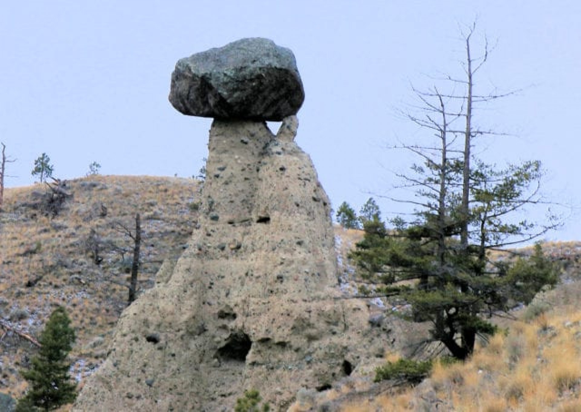
How long will Balancing Rock stay on top of the pillar? Every time I return there, it seems more precariously perched on the eroded conglomerates that support it. We returned to hike the area in early December on a windy, cold day. We hiked from the gate down a single track to the edge of the steep slopes above Balancing Rock then followed a ridge above the hoodoos below, but we also dropped down through the hoodoos for some scrambling on the steep sideslopes. We then climbed back to the benchland, winding on gentle slopes above the gullies, looping around to a point with a large erratic where we huddled below the winds to have lunch. We returned up the double track to the gate.

The best views of Balancing Rock is from above on the west side, looking down to Kamloops Lake.
The hoodoos below are eroded conglomerated columns.
The benchland slopes are covered in grasses and sagebrush. Much of the route has excellent views up and down Kamloops Lake.


Our turn-around spot was a large erratic on the nose of the ridge of Six Mile Point.

This is a fine scenic loop for any month of the year, one of the few easy-to-get-to spots on the hills above Kamloops Lake.
More Information:
Doug Smith
Doug writes for Kamloops Trails, a not-for-profit (and ad free) website, offering information on trails, waterways, routes, featured spots, viewpoints, and explorations in the outdoors in the Kamloops area (and beyond).
Doug started exploring this area in 1976 and continues to follow tracks and routes wherever they lead, with the aid of map, compass, GPSr and camera. After many dead-ends, but also many discoveries, he chose to share this information.
The Kamloops Trails website has a massive number of interesting posts and would be of interest to anyone in Kamloops who enjoys the outdoors. Visit the Kamloops Trails website at: http://www.kamloopstrails.ca/
My Blog Posts


